Hike Up Rainbow Mountain in Peru – First Time Over 5 KM Above Sea

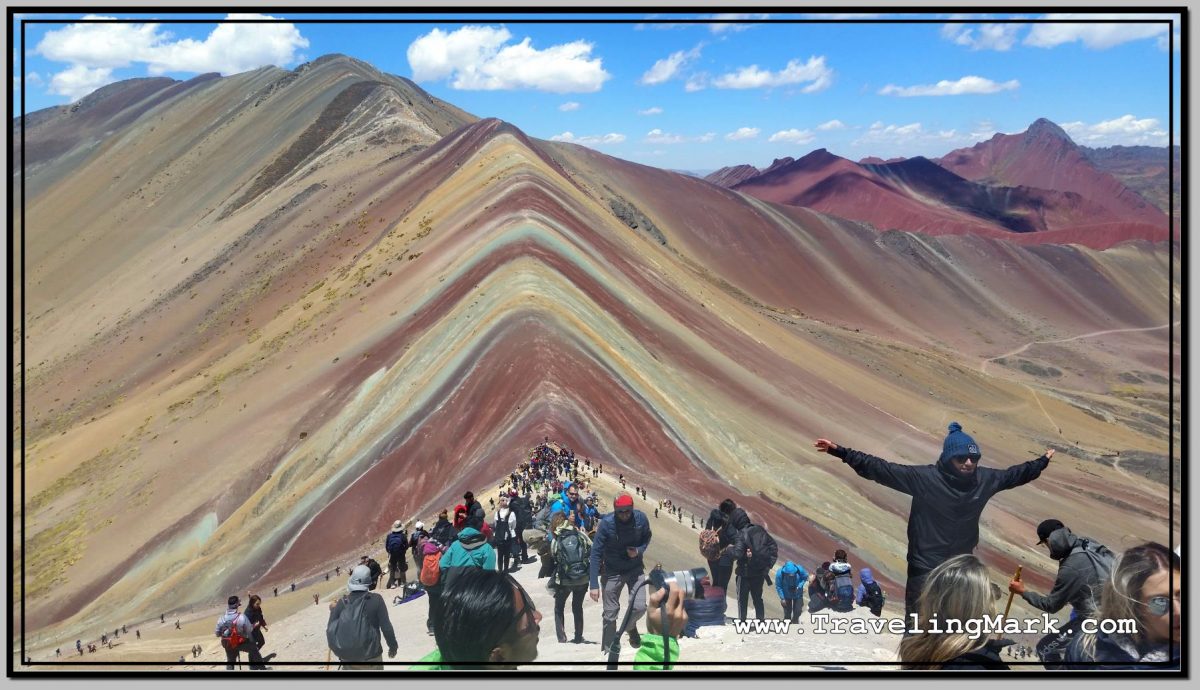
The Rainbow Mountain, locally known as La MontaƱa de los Siete Colores (The Mountain of Seven Colors), or by its official name of Vinicunca (sometimes spelled Winicunca), is one of the newest attractions in Peru. The mountain however belongs to the people of Pitumarca, who call it the “Cerro Colorado“.

Photo: Rainbow Mountain - I Did It!
Photo: Rainbow Mountain – I Did It!

Up until a few years ago, it was under the permanent layer of snow and ice, and nothing made it special or attractive. But as the snow receded, it uncovered the mountainous formation dyed in various shades, product of the complex combination of minerals.

Despite its local name of the Mountain of Seven Colors, according to the information provided by our tour guide, the scientists identified five colors on the slopes and the summit of the Rainbow Mountain – red, purple, green, yellow, and pink – all deposited the base color of the mountain itself.

Photo: Ausangate Sacred Mountain Gave Rise to the Popularity of the Rainbow Mountain

Had you visited the Rainbow Mountain prior to 2016, you would likely be the only one hiking the high altitude trail to its 5,200 meter above the sea level summit. However because it is located on the way to the imposing Ausangate – the snow-covered mountain with an elevation of 6,384 metres – adventurers who dared to ascend Ausangate in 2016 took photos of Vinicunca which they then shared on the social media, sparking the interest in the mountain. Since then, the popularity of the Rainbow Mountain exploded and now it receives hundreds, if not thousands of visitors a day, making it one of the most visited places in the Cusco region of Peru – along of course with Machu Picchu.

Photo: Trail to the Rainbow Mountain Was Littered with Tourists Braving the 5,000 Meters Elevation

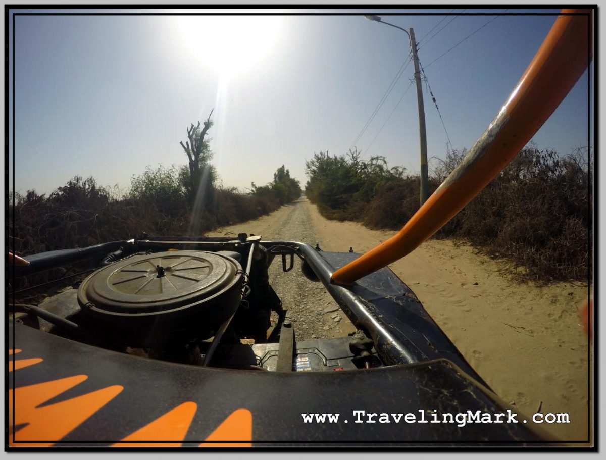
The road to the Rainbow Mountain is along a canyon with narrow passage carved into the steep cliffs of its sides. You have no choice but to trust your bus driver that he knows what he’s doing, with the understanding that if he messes up, you’re dead, but so is he. In other words – he has as much incentive to drive safe as you have the hope he will.

Photo: Sketchy Road Along Canyon Leading to the Rainbow Mountain

Through the whole ride there and back, I was telling myself that one day I will remember it as something crazy I have once done, and that I’m glad I did not die there, but while I was at it, I was realizing I was riding on the Grim Reaper’s tail the whole time and at any given time there were mere inches separating me from certain death. One wrong move on the driver’s part, and everyone in the bus is dead.

There was not a person on the bus who was not clenching his or her butt cheeks so tightly, you couldn’t jam a sharpened hair up anyone’s ass crack, but it was the ones sitting on the side of the bus facing the canyon who were breathless the most. The wheels on that side of the bus were gliding on the edge of the cliff, and there was a long way down. It constantly felt like you’re better off not knowing just how close you are to the edge, and just how far down it is.

Before the final ascend with the bus, we crossed the canyon over the shadiest looking wood bridge ever. That would have induced grasps for air if we were to walkover it on foot, yet we drove over it with the bus. Each of us gasped when we did it. Damn!

Shortly after the bridge, we stopped at the toll booth where our guide paid for everybody’s entrance and our vehicle drove to the parking area, from where we commenced the hike. There were several other vans used as tour buses parked up there, suggesting a high number of hikers on the trail.

Photo: Long High Altitude Trail to the Peak Overlooking the Rainbow Mountain

Locals with horses were offering an option to reach the mountain without straining your heart and lungs, and a number of locals including children were stationed along the trail, selling heavily overprices snacks and beverages, including coca tea for altitude sickness. I asked one horseman how many times he ascends the mountain on an average day, he told me that he does it twice – impressive physical fitness in those people.

Photo: Until Visitors to Rainbow Mountain Were Able to Hire Horses Lead by Locals in Traditional Costumes

The trail offers spectacular views along each step. There are mountain peaks in every direction, some tall enough to be permanently under snow cover. In places you notice the glaciers giving way to mountain lakes, which then trickle down as creeks that carve out the canyon.

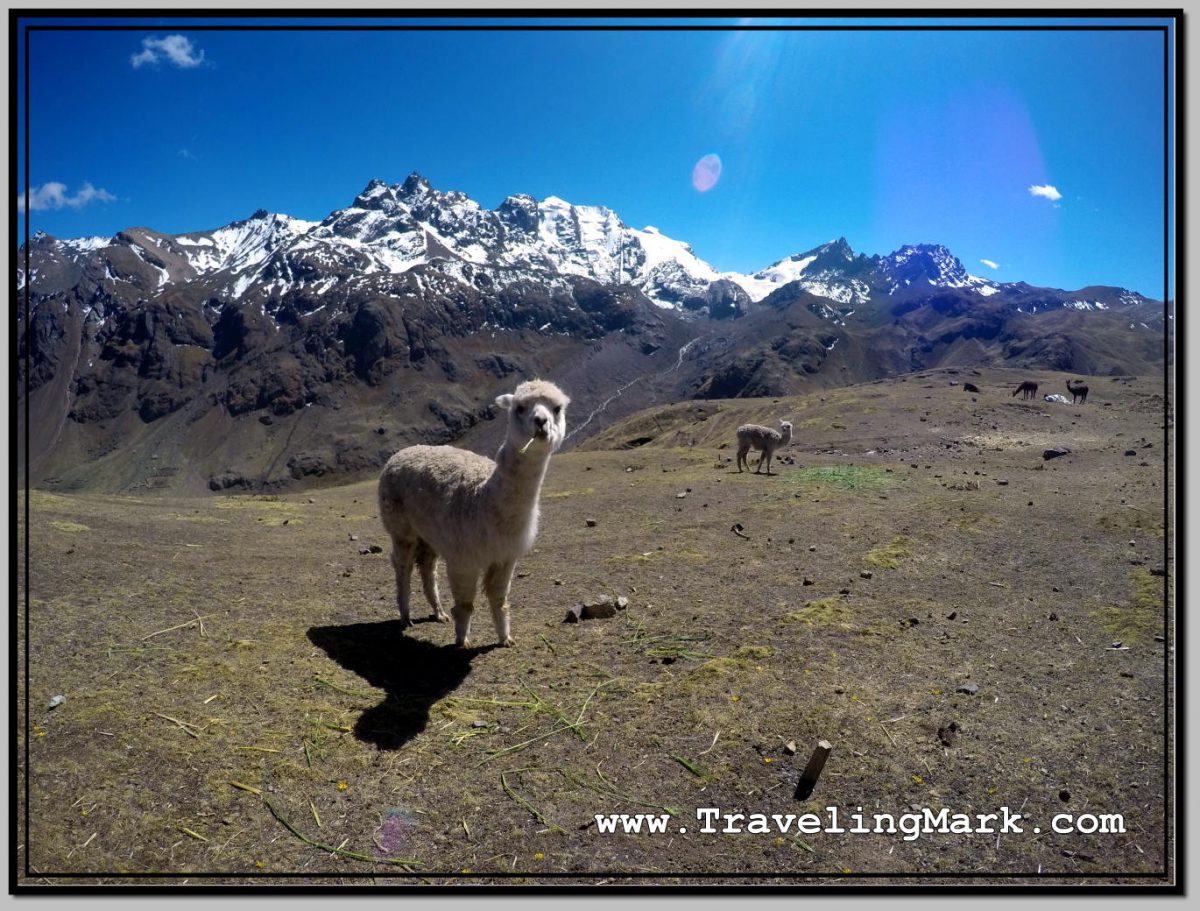
A number of domesticated llamas and alpacas are encountered along the trail.

Photo: Long and Strenuous Hike Up the Rainbow Mountain

The hike itself is rather strenuous, but no part of it is overly dangerous. It starts easy with there being only a slight incline, but it keeps getting steeper the further up you get. If not for the altitude, the trail itself would likely not be such a challenge. But it was the altitude that made everyone daring the trip work for it.

Photo: Red Valley Is Adjacent to the Rainbow Mountain

I myself felt like my muscles definitely had what it takes to get up and down the mountain, but the heart and the lungs were getting a heavy work out. The final approach toward the Rainbow slope was the steepest, so ascending that really tested my respiratory system’s strength and endurance. You could see on everyone’s face how hard of a time they were having taking each step further.

Photo: Standing on the Outcrop Adjacent to the Rainbow Mountain

Taking frequent breaks was unavoidable. Everybody was taking them. Only the ones who took the easy way by hiring a horse passed by us with ease, but even for them keeping their breath up was not so easy. But for us who were also under physical strain, for us the challenge was real.

Photo: On Top with Chilean Couple

It was for these reasons why once we reached the top, we were giving one another hugs and were celebrating together like we’ve just achieved great victory. Because we all did. We won over ourselves. We faced a personal challenge and we pushed through. The feeling of unbelievable achievement is difficult to describe. It has to be experienced. It’s hard to climb the Rainbow Mountain. It’s really hard, but if you fight through it regardless, and keep going even after your body has told you a million times it wants to quit, you’ll experience the feeling of achieving what you did not think you were capable of, and that feeling is incredible.

Photo: Smile You Wear After Pushing Yourself Into Succeeding

The access to the Rainbow Mountain itself is prohibited, apparently with the intent to preserve its delicate surface. From the foot of the Rainbow Mountain, one can continue up to the outcrop from where there are the best views of the mountain colored slopes. The top of the outcrop, named Montana Winikunka, is at the elevation of 5,036 meters above the sea level. That is just a little lower than the Mount Everest base camp.

Photo: Sign Prohibiting Access to the Rainbow Mountain

This was the first time in my life to have climbed to the altitude in excess of 5,000 meters and having achieved that felt amazing.

Photo: Mountain Winikunka - First Time in My Life Climbing to More than 5,000 Meters Above Sea Level
Photo: Mountain Winikunka – First Time in My Life Climbing to More than 5,000 Meters Above Sea Level

From the Rainbow Mountain, an option exists to detour to the Red Valley, but this was not included in the tour I took. The combination of the two is usually done as a two day tour with a camping stay overnight on the mountain.

Photo: Rugged Red Valley with Slope of Rainbow Mountain in Bottom Left

What the future holds for the Rainbow Mountain is anyone’s guess, at this stage. The locals have been milking the living hell out of the high popularity that’s exploded over the past couple of years, but on March 16, 2018, a mining concession was made to the territory where the mountain is located. The Geological, Mining and Metallurgical Institute of Peru handed over mining rights to the Canadian mining company Camino Minerals. I’m glad I got to experience the mountain before heavy machinery rolls in and the are is turned into a mining ground.

Photo: Climb Up the Rainbow Mountain - What an Experience
Photo: Climb Up the Rainbow Mountain – What an Experience

With all its ups and downs, he Rainbow Mountain became the best place I visited during my stay in Peru. Unfortunately, it was followed by the worst – the trip to Machu Picchu.

Here’s a short video from the hike and the joys of having reached the top:

Buying Rainbow Mountain Tour in Cusco While Staying at El Viajero

Having concluded my weekend in Lima, I returned to Cusco. The 22 hours long bus ride seemed as neverending as when I went the opposite way.

Instead of going back to Hostal Margarita where I stayed when I first visited Cusco, I however decided to try out El Viajero Hospedaje, because it was close to the bus terminal. I quickly came to regret the decision.

El Viajero

The room at El Viajero cost 30 Soles, the same as at Hostal Margarita, but to my shock, after an hour of stay, the owner switched off the wifi router, shutting off the internet for me.

Photo: El Viajero Hospedaje in Cusco, Peru - I Had to Get Up at 4am but Waited 2 Hours for Tour to Rainbow Mountain to Arrive
Photo: El Viajero Hospedaje in Cusco, Peru – I Had to Get Up at 4am but Waited 2 Hours for Tour to Rainbow Mountain to Arrive

When I confronted him about it, he said I’ll only get an hour of internet, and if I want more, I would have to pay for it. I quickly said I’m canceling my stay there and demanded my money back, because before moving in, I had done what I always do with every single place before I pay for a room – I asked whether the rooms come with free wifi internet. Whereas he confirmed I’d get free internet with the room, I agreed to stay there, so now that he was changing the rules after the game has started, I was having none of his crap.

With unshakeable determination I told him I demanded my money back and proceeded to pack up in order to immediately leave. After that, he said he’s gonna turn the internet back on for me, although after a few hours, he turned it off once again.

That sparked another argument from me, until he eventually agreed not to turn it off again.

Booking Tour to Rainbow Mountain

Meanwhile, I went out to find out what it’d cost to book a tour to the Rainbow Mountain. I have never heard of the Rainbow Mountain before (known locally as la Montana de Los Siete Colores – the Mountain of Seven Colors), but it was strongly recommended way back after I had just landed in Peru, and hang out in downtown Lima with Isadora from Brazil.

Photo: This Is Emma, She Is British, We Climber Part of the Rainbow Mountain Trail Together

I went to a few tour operators in Cusco and enquired about the prices for the Rainbow Mountain. While there were some overpriced options, general cost seemed to be in the neighborhood of 60 Soles for the trip, including the 10 Soles entrance fee (Peruvians milk tourists every chance they get, so every time there is a new attraction, they instantly introduce an entrance fee).

Several tour operators advertised what they promoted as a great price for the trip to the Rainbow Mountain at 50 Soles, but that was just a marketing gimmick, because unlike the regular 60 Soles worth tours, the 50 Soles ones did not include the 10 Soles entrance fee so the end cost for the unaware tourist would in the end be the same anyway. It would appear that the deceptive marketing works out well, because in the tour bus I took, all but two people fell for it, thinking they got a better deal.

Photo: Alpaca Calmly Grazes on Grass Along the Trail to Rainbow Mountain

The Rainbow Mountain tours start early in the mornring. The include pickup from the hotel and I was told to be ready for my pickup at 4:30 am. Whereas the tour would last whole day, what it meant for me was that I would have to leave my room at El Viajero with my backpack, because there was no way I was staying there for another night

I would have preferred to have stayed in a reasonable place where I would have been able to leave my baggage while I’m up on the mountain, but El Viajero simply wasn’t that place, so I had no option but to haul all my crap with me, so I can book me a room elsewhere after I’ve returned from the Rainbow Mountain. Standard check out time in Cusco is ridiculous 10am. The return from the Rainbow Mountain was not expected until 5pm.

Photo: Indigenous Girl I Met on the Way to the Rainbow Mountain

As is also pretty standard with tours in Peru, even though I got up at 4am in order to be ready for the pickup at 4:30 as per the instructions I got, the tour bus didn’t show up to pick me up until 6:30am. I would have gotten 2 hours more sleep, had they been up front with me that nobody’s gonna bother picking me up nowhere near on time. After my previous experience booking a tour in Peru, I should have known better.

Food Included

The Rainbow Mountain tour also included breakfast and lunch. As is almost always the case, each time the tour comes with a meal included, you’d be better off paying less for the tour and not have it included, and either bring your own sustenance with you, or pay for your own food along the way.

Photo: Drivable Section of the Road Leading up to the Rainbow Mountain Trail

The included food is in a restaurant that pays the best commission, and it’s mass produced to maximize profit. I was told it would be a buffet style service, but all there was for the breakfast buffet were a few baked breads with butter and jam, plus a cup of tea. The latter was the only thing I used, as pure carbohydrates with no nutritious value of the rest did not attract me at all. Luckily, as far as the tea was involved, the restaurant did provide coca leaves, which are known for being beneficial when braving high altitude, and give the drinker a bit of an energy boost.

The lunch, which was served in the same restaurant on the way back from the mountain, was not a big win either. A tray of rice, a tray of a bit of chicken, a plate of lettuce and a pot of soup were provided, but there was so little of each, by the time one half of the bus filled up their bowls with soup, there was none left, and likewise, with the exception of rice of which there seemed to be enough, only the first ones at the tray of chicken got a reasonable portion.

Photo: Restaurant Was Not Much, But Mountainous Scenery It Was In Was Breathtaking

Basically, for my breakfast buffet I got a cup of coca tea, and for my lunch buffet I got a scrap of chicken with a small side of veggies and that was it. The jugs of juice that accompanied the lunch were filled with some syrup water loaded with sugar.

Other than that, the trip to the Rainbow Mountain itself was amazing. For me, it counted as the best experience I have had in Peru, mostly because it was the first time I climbed to over 5,000 meters above the sea level and even though it was tough on my body, I pushed myself and battled through the low oxygen environment and did it. The feeling of accomplishment was amazing, as were the views of the spectacular mountainous scenery.

Photo: Those Not Fit Enough to Hike Up the High Elevation Trail, Can Use Services of the Many Horsemen with Horses

Just as Isadora strongly recommended a trip to the Rainbow Mountain to me, I also strongly recommend it to anyone visiting Peru. It’s a high altitude hike so it’s not a walk through a park, but if you push through and reach the top, the reward will be very much worth it.

Photo: Rainbow Mountain - Hell Yes I Did It!
Photo: Rainbow Mountain – Hell Yes I Did It!

Touring Downtown Cusco Alone on Foot

After settling at Margarita Hostel on Avenida El Sol in Cusco, I went out to explore the city. Cusco is the most popular city in Peru as far as the number of tourists is involved, and notwithstanding the proximity to Machu Picchu, after a short period of time touring the city alone on foot, I was amazed by the fusion of the Andean and Spanish cultures in the middle of beautiful landscapes, with the abundance of historical buildings often built on bases and walls of ancient palaces and temples of the Inca Empire that seemed to be greeting me after every corner I took.

This is not surprising, as Cusco was the hegemonic center and the capital of the Inca Empire (locally known as Tahuantinsuyo), and the most important urban center of ancient Peru at the time.

Brief History of Cusco

The city, founded by the Inca Manco CƔpac, was made up of large palaces, temples and courthouses, with streets and squares, surrounded by extensive areas for agriculture, crafts and pre-industrial production, reaching its greatest development during the reign of the Inca Pachacutec in the fifteenth century.

Photo: Statue of Inca Manco Capac on Top of Fountain at Plaza de Armas

When the Spanish conquered the Inca Empire in 1534, they founded and built the Spanish city on Inca enclosures and buildings, which can still be seen.

Despite the passage of time, Cusco remains an attractive city for tourism and maintains a remarkable monumental ensemble and the coherence of its urban layout; its streets interspersed with the same magnetism, colonial constructions and Inca walls, churches and pagan temples, archaeological sites and rural haciendas.

Altitude of Cusco

Located in the Peruvian Andes at 3,400 meters above the sea level, which albeit being a few hundred meters below that of Puno, Cuzco is still at a high enough elevation to warrant caution and take the possibility of altitude sickness seriously. I felt partially acclimatized, having lived a week in Arequipa and three days in Puno.

Still, as I walked the sloped streets of Cusco, I was continuously reminded by the shortness of breath that the elevation I’m in is high and I need to be at minimum aware of it, if not taking active steps to alleviate its effects. Luckily, the occasional shortness of breath was the only effect of high altitude I have experienced, with other common symptoms, like the headache, overproduction of phlegm in the throat and nose, or even fever like symptoms completely avoiding me.

Touring Cusco’s Downtown Core

The Historical Center of Cusco has been continuously inhabited since before 1,400. A royal cedula of July 1540 refers to Cusco as “the very distinguished, very remarkable, loyal and very faithful City of Cusco, the main city and head of the kingdoms of Peru“.

Photo: Busy Traffic in Front of Convent of Santo Domingo in Cusco

From the records by some chroniclers, and from the latest satellite images, it is known that the first urban layout of the city had the shape of a puma.

The narrow cobbled streets, churches, old neighborhoods and colonial houses, as well as several archaeological monuments, are a sample of a mestizo culture that has survived time, invasions and natural disasters, and remains alive despite the passage of the centuries.

The Historic Center of Cusco, despite many historical events and natural disasters which occurred, is in an amazing state of preservation; and thanks to that, the City of Cusco was declared Cultural Patrimony of the Nation in 1983; the same year it would be declared a Cultural Heritage of Humanity by UNESCO.

Cusco Massage Services

With Cuzco being as popular as it is with tourists, and with Avenida El Sol connecting directly to Plaza de Armas, it is expectedly replete with various travel agencies looking to score tourists’ dollars for themselves. The good thing about that is that they are a bountiful source of maps of Cuzco for those who don’t have MAPS.ME open source maps app on their smartphones.

As a backup, I always have the off-line map of the country I’m in downloaded on my phone, but where there is an opportunity to pickup a printout of a map, I do so, so as not to drain the phone’s battery by constantly looking at its screen.

Seeing as Plaza de Armas is just a short walk up Avenida El Sol from where my hostel was, I took the walk to snap a few pictures of the downtown square. The moment I reached Plaza de Armas, I was jumped by a swarm of women offering me massage services.

I was quoted prices around 50 Soles per hour, which albeit touted as a great price, is indeed no so great for anyone who’s had a massage in Asia.

Photo: One of Better Looking Baits for Massage Parlors Approached Me While Taking Photo of Plaza de Armas in Cusco

At the time of my visit, 50 Soles equaled a little more than $15 US. You can get a 1 hour full body Thai massage for $5 in Thailand, 1 hour of full body Khmer massage for $4 in Cambodia, or 1 hour of full body general massage for $3 in the Philippines, and if that’s also your thing (such as it is mine), Asian girls are fit and attractive, whereas Peruvian women are overweight and generally lack in the overall corporal attraction level quite a bit.

So for me, getting an hour long massage for $15 US from a woman who’s at best a 3 or 4 was a no go. I’ll save getting massages for where they cost $5 or less and are given by girls who are a solid 8 or 9. I flirted with some of the girls offering massages in Cusco, but never ended up getting one.

Convent of Santo Domingo

I started my tour of downtown Cusco by visiting El Convento de Santo Domingo, because it was located directly on the opposite side of Avenida El Sol from Hostal Margarita. The convent of Santo Domingo is built on the foundations of the Qoricancha (Temple of the Sun).

Photo: Peruvians Baiting Tourists to Spend Money in Front of Convent of Santo Domingo

Plaza de Armas

Cusco’s main square Plaza de Armas occupies the same place as the Plaza Huacaypata (Quechua for voice, moan or lament) that was drawn by Manco CĆ”pac when he founded the city of Cusco in the 12th century. It was the place where the Inti Raymi – a religious ceremony in honor of the Son god – was celebrated in the time of the Incas.

Photo: Arches on Plaza de Armas with La CompaƱƭa de JesĆŗs in Background

From the arrival of the Spaniards it was somewhat diminished in its dimensions by the perimetric constructions, which adorn the square to this day, like the Cathedral, the Church of the Company, the portals, arcades and large houses. Today, the houses surrounding Plaza de Armas are homes to jewelers, travel agencies, tourist restaurants, massage parlors and other establishments catering primarily to foreigners. Strangely, there is no McDonald’s, KFC, Starbacks or the such at Cusco’s Plaza de Armas.

Photo: The Cathedral of Cusco Overlooks Plaza de Armas from Steps

Jose Gabriel Condorcanqui Noguera, better known as Tupac Amaru II, the leader of a large Andean uprising against the Spanish, was executed at Plaza de Armas on May 18, 1781.

Cathedral of Cusco

The Cathedral of Cusco is a catholic temple built on what was the royal palace of the Inca Viracocha (Huiracocha). It was built with blocks extracted from an Inca site very close to Sacsayhuaman. Construction began in 1559 and was completed almost a century later.

Photo: Wide Angle Shot of La Catedral del Cusco

Church of the Company of Jesus

Iglesia de La CompaƱƭa de JesĆŗs is a colonial Jesuit Temple, built on the Royal Amarucancha Palace of Huayna CĆ”pac in 1,571. It is said to be surrounded by labyrinths and secret passages, in which Notable characters of the conquest and Spanish colony were buried.

Photo: Church La CompaƱƭa de JesĆŗs in Cusco, Peru

The Convent of La Merced

The building of El Convento de la Merced looks very much like El Convento de Santo Domingo (see above). Its almost rustic walls contrast very well with its beautiful columns and its baroque bell tower.

In the basements of the church are said to rest the remains of the Spanish conquistadors Diego de Almagro, Almagro El Mozo, and Gonzalo Pizarro.

Photo: Snake Decoration in Front of El Convento de la Merced in Cusco

San Pedro Market

From Plaza de Armas I walked on to Plaza de San Francisco, and from there along Calle Santa Clara to San Pedro market. The vendors sell fruits, dried nuts, health care products, and other items commonly found at markets in South America, though being so centrally located in Cuzco, the great part of the market was dedicated to selling overpriced handicrafts to unaware tourists.

Photo: Main Entrance to San Pedro Market in Cusco

As a matter of fact, pretty much everything was heavily overpriced in the market. Fruit availability was decent, but the prices excessive. However one stall, which sold dried fruits and nuts was worth it for me due to the availability of Brazil Nuts, Almonds and dried Figs. The prices weren’t the greatest, but I was more happy with the ability to buy healthy, non-perishables than anything else, so I adequately resupplied.

Photo: Santa Clara Arch on Way to San Pedro Market

Opposite San Pedro market is Orion supermarket, where local mineral water in 2 liter bottles was sold for only 2.40 Soles. That was a great price in the country where a 2 liter bottle of ozone treated tap water normally costs 5 Soles (yes, Peru is expensive). So in spite of being generally pricey, this quality mineral water, which was also highly alkaline (PH 8.5) was available in Cuzco at a better price than treated tap water without any nutritious value in the rest of the country.

Short Stay

Overall, my introduction to Cuzco was OK. I got the feel of the city, got to know its vibe, got myself oriented in it pretty well, got to know where to find reasonably priced accommodation and where to purchase essentials for survival. But my initial trip to Cusco was not meant to last.

Photo: Convento de Santo Domingo at Night

Upon my early morning arrival in Cuzco, I took advantage of a temporary promotion for return trips to Lima by the bus company Civa, who sold the return tickets for 90 Soles. Having chatted on the internet since arriving in Peru with a girl from Lima, and having arranged an opportunity to rent a room in an apartment owned by a Spanish woman living in Peru for 50 Soles a night, I combined all three to spend a weekend in Lima and return to Cuzco afterward to begin my trips to the sites of interest during weekdays, and not during overcrowded weekends.

There was more to explore in downtown Cusco, but I chose to return to the room in Margarita Hostel to spend the night, after which I was scheduled to take the 22 hours long bus ride back to Lima.

Tour to Sillustani Pre-Inca Ruins Outside Puno

While my first night in Puno was plagued by cold and noise, the second one was just cold. But it got really cold. It was reasonably quiet in Hotel Inka Tours, which I desperately needed, but as the wind picked up at night, it got so cold, I could not stop shivering.

I concluded that I simply am not equipped for stay in such a cold place, and made the decision to leave after the second night. Puno was colder than I expected and I simply did not have warm enough clothes to handle the relentlessly cold nights.

I checked out of Hotel Inka Tours at 11am and headed for the bus terminal where I purchased a ticket to Cuzco on an overnight bus. Whereas several providers offered these trips, I specifically asked each one if they would hold my luggage until the bus’ departure at night, so I can go out and do some more exploring during the daytime.

Company Mer was happy to store my luggage until the departure so I bought the ticket with them, and proceeded to make arrangements to get me to the archeological complex of pre-Inka ruins at Sillustani.

Photo: Lama Used as a Lure in Front of House on Way to Silluani to Attract Tourist and Charge Them for Photos

Located on the shores of Lake Umayo in the Umayo Atuncolla district of the province of Puno, the near 40 kilometers long journey to the archeological site involved a bus to the access road from where I took a taxi to cover the last few kilometers.

Having passed by a number of traditional houses with llamas in front of them to attract tourists and charge them for taking pictures of the animals, I found myself at the entrance to Sillustani, which was likewise turned into a tourist trap with numerous sellers of overpriced handicrafts and high-cost bottled water. The use of bathrooms was also one of the most expensive in all of Peru. The entrance fee to the complex was 10 Soles.

Photo: Selfie at Lizard Chullpa

Sillustani was used as a necropolis and is littered with “chullpas” – funerary towers built on the hill overlooking the Umayo lagoon. The location with breathtaking views of the lagoon would make for a captivating trip even if archeological sites are not your thing.

Chullpas of Sillustani

The chullpas are tower like structures built as tombs by the Qulla people, a subgroup of the Aymara indigenous nation, before they were conquered by the Incas, and later by the Spanish.

Photo: Set of Older Chullpas at a Further End of Sillustani

The majority of chullpas at Sillustani are circular and made of stones. In some, the archeologists found mummified bodies particularly well preserved thanks to the cold and dry climate of the Altiplano. The tombs also held ceremonial objects in gold, although the majority is believe to have been lost to grave robbers.

Photo: View of Lizard Chullpa from Location of More Remote Chullpa

All Chullpas have a single, small door facing east. This direction has been symbolically chosen to represent the rebirth of the soul through the sunrise. The oldest Chullpas are said to have been built by the Pukara civilization at around 800 BC.

Photo: Ramp of Rocks Is Presumed to Have Been Used to Get Large Stones on Top of Chullpas

They are spread out across the hill, so even though I kept a decent pace without pausing for too long at any one structure, it took me an hour to get to all the main ones.

Lake Umayo

You can see the marshy side of Lake Umayo as soon as you enter Sillustani. But its true beauty does not reveal itself to you until you’ve climbed on top of the hill housing the Chullpas. With its flat-top island in the middle and steep cliffs on the fringe, the lake truly rewards the visitor braving the high elevation climb to Sillustani.

Photo: Flat Top Island on Lake Umayo

The 125 hectares large Umayo Island is called Intimoqo by the locals. There are diverse legends surrounding Laguna de Umayo, such as the one that says that its water is saltier because it is the tears of the princess Ururi, who poured them when losing her beloved. In the face of so much pain the Sun hid and there were years of drought and hunger, until their parents guilty of the drama, implored the return of the Sun, but their tears also arrived at the lagoon, making it saltier. After the return of the Sun, only the time and the less suffering of the people made it less salty, so that the fish returned and procreated.

Photo: Partially Collapsed Chullpa with Laguna de Umayo in the Background

What to Expect

The highest point of the area, according to the information I got from the locals, stands at 4,000 meters above sea level, which is a significant elevation so one should take precautions against possible altitude sickness. Having been built on a hill, the walking around Sillustani involves a lot of uphill trekking that is sure to get your heart pumping and lungs gasping for more air.

Photo: Lizard Chullpa Is The Most Iconic

When I was there, the sun was blasting something intense, so making sure you put on sunscreen before heading to Sillustani. At that elevation you have 4 kilometers less of dense air blocking the sun rays compared to the sea level, but even though the temperature would not suggest it, the intensity of the rays is savage despite seeming that way.

Photo: Flowers Like This Surrounded with Thorny Spokes Can Be Found on Sillustani Hill

A light jacket would also come in handy as once you reach the top of the hill, the wind really picks up. I did in in just a long sleeve shirt and was fine, but the biting wind would have been too much for a short sleeve.

Photo: Intiwatana - Ceremonial Circular Structure Build by the Incas
Photo: Intiwatana – Ceremonial Circular Structure Build by the Incas

Overall I found Sillustani overly touristy. The ancient structures were interesting, but for me the highlight were the views of the lagoon surrounding the hill on which the chullpas were built. Make sure you bring your own bottle of water so you’re not left having to buy the overpriced small bottles sold in the local shops lining the sidewalks of the village.

Photo: Chullpa with Umayo Island Inside the Lagoon

Touring Arequipa with Milagros

While on my way to get to know Arequipa, I met a local girl who said her name was Milagros (meaning “Miracles“). At first I thought she was messing with me, but apparently it’s her real name and said name is actually quite popular among females in Peru.

Photo: In Front of Bronze Statue of Bull with Milagros at Menelik Museum

Milagros is from Lima, where she works for a bank. The bank sent her for a month to Arequipa. She arrived a day before me. We were both new to the city, and ran into each other as we both sought to get to know it.

We got along well, and went together to a couple of areas in the city located up on hills, from where we got better, unobstructed views of the mountains at the foots of which Arequipa is built.

Photo: View of Misti Mountain from Mirador in Yanahuara, Arequipa

Misti is perhaps the most iconic of them all, as it towers on its own, forming a spectacular mass of rock seen from almost any part of the city. At the impressive 5,888 meters above the sea level, Misti is however not the tallest. The one to the left of her is Chachani, who’s over 6km above the sea. Both Misti and Chachani, per what I was told by the locals, are active volcanoes. Both had visible snow on their peaks.

Photo: Posing for Pic with Chachani Volcano in Background

There is a third volcano to the right of Misti, called Pichu Pichu, but we never got a good view of that one, perhaps due to the pollution which made the mountain further away very indistinct.

One of the lookouts we visited – Yanahuara – is a bit off the beaten path from the attractive downtown core, but I found it to be well worth the trip. Its somewhat unimpressive square is made interesting by the sillar stone arches outlining the mirador, and a neat Catholic church just across the road from it.

Photo: Arches of Yanahuara Mirador in Arequipa, Peru

On the arches are engraved quotes from famous Arequipa citizens. There was also an interesting totem pole near them, and an old church on the other side of the road.

Photo: We Asked Someone to Snap Picture of Me with Milagros in Front of Misti Volcano

We also went to the Menelik Museum. It’s the museum dedicated to the memory of one of Arequipa’s most famous fighting bulls that reigned in the 1940s.

During the brief presentation by a guy from the museum, we were told that Menelik was a Champion bull who beat all then existing bullfighting records, wounding or killing many of his brave and dangerous contenders, and died gloriously undefeated.

Photo: You Can Safely Mess with Thus Bull to Get the Horn

At the time of his death, Menelik weighed approximately 1,200 kilograms. Not only was he the best fighting bull in the Arequipa countryside, but he was the one who contributed most to the progress of the community, the construction of schools and public works, thanks to his triumphs.

There is a huge 3D model of the bull said to be lifesize. For a 5 Soles entrance fee, you can sit on the plastic bull for a photo, and marvel at preserved heads, as well as a hyde of other large bulls.

Photo: Lifesize Replica of Giant Bull Menelik

There isn’t a whole lot to see at Museo Menelik, and the presenter spoke too fast for people with limited command of Spanish to understand, so it may not be a worthwhile trip for many visitors to Arequipa, but I quite enjoyed the museum and don’t regret paying the entrance fee.

We also wandered around the downtown core of Arequipa, snapping photos of the cathedral which is on one side of Plaza de Armas, as well as the uninspiring fountain in the middle.

Photo: Cathedral of Arequipa Behind Plaza de Armas

Arequipa is known as the “White City” (La Ciudad Blanca), a moniker allegedly derived from ashlar – the white volcanic stone used for building many of the city’s historical buildings. The rock is said to be from the solidified volcano ashes.

Photo: Plaza de Armas Is Surrounded by Buildings from Ashlar

The downtown core indeed is impressive and its old architecture very photogenic. Many of the historical buildings were re-purposed and now house branches of banks or other bigger institutions.

Photo: One of Repurposed Buildings in Arequipa Now Home to a Bank

I also liked the area around the San Francisco de Asis monastery. The street of San Francisco is where a lot of night bars are located, and it’s said to be a good place for gringos who want to pick up available Peruanas after dark. I went to a place called Deja Vu on one occasion, and got to participate in free Salsa class which was interesting in that the women were made to rotate after every learned set of steps, so you get to practice each move with a different partner. Both local and foreign girls as well as boys took part in it.

Photo: San Francisco de Asis Church in Arequipa

Even at night, the downtown of Arequipa, and Calle San Francisco in particular, are safe thanks to the heavy police presence. At night, the entire street had a cop stationed on every 5 to 10 meters on either side.

Photo: At More than Six Kilometers Above Sea Level, Chachani Volcano Is the Highest Peak Around Arequipa

Overall, other than the really annoying and bountiful touts in and around the bus terminal, I enjoyed my stay in Arequipa and would not hesitate paying it a return visit. I would however not take a taxi as the risk there was just too high.

Photo: Mirador Carmen Alto Offers Views of Arequipa Farmland with Misti and Chachani in Background

I concluded my tour of Arequipa by taking Milagros for supper in one of the upscale restaurants on Calle San Francisco. She ate Chicharron de Cerdo (pork cracklings), I was intrigued by a stew that said it would be either beef or alpaca. I asked the waitress if they had alpaca and said I would order it if that was the case, otherwise I’d go for fried trout.

She assured me they had alpaca meat, so I went with the stew. This was the first time in my life I’ve eaten meat from Alpaca, and found it to be very tender and flavorful, with no fat. The food in the restaurant was great. I even got my non alcoholic beverage in a Moscow Mule Copper Mug:

Photo: Alpaca Stew with Beverage in Moscow Mule Copper Mug

Riding and Sandboarding the Dunes of Cerro Blanco

Once everyone had their fill of human remains from the Nazca desert cemetery, we rode our “buggy” deeper into the desert and toward the sand dunes of Cerro Blanco.

Here’s the video of fun our driver was having with us as he gave the buggy hell riding the dunes up and down:

Cerro Blanco was our last scheduled stop, after which we were to return back to Nazca. However, because the tour started more than an hour late, the journey toward the dunes was done when daylight was fading, and by the time we had our share of fun snowboarding down the dunes, it was dark and we had ahead of us almost an hour long journey back to town, but this time not only through the stormy winds, but also through near freezing nighttime temperatures.

Sandboarding was hell of a lot of fun, though. We already had sand everywhere – in our teeth, in our eyes, in our ears, as well as in all our clothes and inside our socks, so rolling around in sand was not gonna make it any worse than it already was. So we just went for it and enjoyed every minute of gliding down those endless sandy dunes:

But the ride back was rough as all hell. The wind was as relentless as ever and it was just overall brutally cold, so with the “buggy” providing absolutely no protection from the elements, the endless ride back through the pitch black desert as nobody could catch a break from violent shivering, was savage. I was a trembling wreck walking to the hotel after being dropped off, but at least at that time I knew that the hellish ride was over.

Nazca Desert Cemetery with Sun Bleached Human Remains

Having gotten seriously windswept by the sand storm on the way to and at the Cahuachi Pyramids, our Edunas tour continued through the desert surrounding Nazca into an ancient cemetery that was in the recent years looted by treasure hunters.

The harsh weather continued as we were getting hit by strong winds and sand kept blasting into our faces and every bodily orifice. The entire landscape we were passing through however kept me very appreciative of the experience.

Photo: Landscape Around Desert Cemetery Is Very Moon Like

I have never seen anything like this before. I kept thinking to myself – if NASA wanted to fake another moon landing or a Mars mission, they could film it here and nobody would believe it could have been filmed on Earth. In Peru. Absolutely mindblowing, moon-like scenery kept emerging from every dune, after every turn.

After passing several kilometers across unmarked desert (props to the driver), we reached the cemetery, which was essentially a large swath of the desert within the endless sands of which the Nazca culture buried their dead.

Photo: Skull and Bones at Nazca Desert Cemetery

The graves were disturbed by treasure hunters who thought they would find gold or other valuables with the dead, as other ancient South American cultures used to do that, but the Nazcas did not. Consequently, the looters came off either empty handed, or with little of truly high value, forever changing the historical site they had ransacked.

Photo: Hills Containing Human Remains from Nazca Times Were Recently Looted by Treasure Seekers

It would appear that the Nazcas were creating mass graves, which would consist of the piled up dead who were then covered with sand, creating sand hills within which the corpses of the deceased were meant to dwell. The living, having had the strong beliefs in the afterlife, buried their dead along with pottery filled with food, so they have something to eat on their journey into the outer world.

Photo: The Living Left Dead with Pottery Filled with Food Such As Corn for the Deceased

As a result, the sun bleached bones are often mixed up with blackened corncobs, clay pots, even ropes. The whole area has a very surreal feel to it. Some of the skulls still have the original hair attached to them. Many are remarkably well preserved by the dry, dusty climate.

Photo: Jawless Skill Rests on Femur

Our tour guide told us the cemetery had been lost under the sands of the Nazca Desert until 1920, when it was rediscovered by tomb raiders. The ransacking left many of the bones and skulls unearthed, offering one a unique opportunity to find themselves surrounded by a sea of bone matter, but the ransacking caused that peace of the ones buried there has been disturbed.

Photo: Nazca Sign Built from Sun Bleached Bones

Our driver snapped a picture of me sitting in the buggy, while other tour-goers still wandered among the bones of the dead:

Photo: Hanging Inside Edunas Buggy

Riding the Sand Storm to Adobe Pyramids at Cahuachi

Unless you visit Nazca or its surroundings between January and March, the weather you will encounter will be sunny and hot, with no clouds to obscure the sun during the day, but bone chilling cold at night.

You can tell by the entire surroundings that this place is baked by the unobstructed sun a lot, and by just visiting outside of the brief rainy season, it’ll all make sense why. Nazca is for all intents and purposes a desert with everything that makes a place a desert.

At 2pm when the Edunas tour was scheduled to start it was an unbearably frying day. At 3 something pm when it factually started, the day was still unbearably frying. Taking a bit of an air in an open “buggy” during the ride to and from the aqueducts was a welcome refresher. But things quickly changed after we started the passage across the vast desert field separating Nazca from the Adobe Pyramids at Cahuachi – ceremonial center of the Nazca culture.

Photo: Gradient Sky Over the Pyramids of Cahuachi

A few minutes into the ride, we were hit by a savage sand storm. The wind came out of nowhere and hit us with so much force, every single one of us had sand in every single orifice and pore. Our driver told us he’s been doing these tours for years, but has never experienced anything like that before. He however encouraged us by saying that the storm will likely pass in maybe 10 or 20 minutes and everything will go back to normal. That actually never happened.

Photo: Tour Goers Holding On to Their Hats While Visiting the Pyramids of Cahiachi

We arrived at the Pyramid, where we were getting relentlessly hammered by the wind so strong we could barely hold our footing. A guide was trying to tell us the history of the pyramid, but no one could hear a word of what he was saying, plus standing in this wind that relentlessly blows sand into you and shows you not a bit of mercy was no fun at all. I remember catching something about only 5% of the entirety of the complex having been uncovered so far. Yet the uncovered part was already expansive.

Photo: Ancient History Within Touch

Being an active archeological site, the visitor walkways were marked with white stones and signs everywhere reminded us all to not wander off marked walkways. Meanwhile, the storm kept pounding the living crap out of us, and whereas our vehicle was an open “buggy“, we had absolutely nowhere to hide from it.

Photo: Faking a Smile While Getting Blasted with High Winds

The road to the pyramid consisted of about 20 kilometers of an unpaved desert crossing. The storm encompassed the entire desert, so we were within it during the entire crossing, the visit to the pyramid and basically the entire time henceforth.

All those scenes you see in movies about people layng on the ground and covering up with specialty blankets to wait sand storms out, before they emerge from two feet of sand on top of them – that’s what we should have done, but instead kept going.

Photo: White Stones Mark the Walkway at Cahuachi Pyramids

You could not keep your eyes open because sand was getting blown into them. Your regular shades are worthless during a sand storm. No matter how tightly you kept your lips together, you could always taste the crunch on your mouth as sand got in there anyway. When I reached into my ear to clean off the collected sand from the ear canal, I was surprised by the thick layer that accumulated in there in minutes. The clothes – I stopped worrying about those very quickly. I could feel sand between my toes as it snuck its way through my hiking boots into the thick sheep wool socks.

Photo: Walls of Ceremonial Center of Nazca Culture at Cahuachi

It was simply brutal and I got to say I got more than I bargained for from the tour. How awesome is that? Sure I got the absolute living crap beat out of me, but the whole time I was thinking to myself – holy s%$t, I’m riding a massive sand storm in Nazca, Peru.

Photo: Tallest Structure at Cahuachi

Money could not buy that experience. I’m in the real desert and the desert sure lets me know she’s indeed real. No joke, this was some serious sand storm and we spent hours in it without any protection, including an hour after dark, when the temperature dropped to near freezing. Talk about adventure in every sense of the word. This I will surely never forget. I’m not even sure the word “relentless” does it justice.

Check out the video that provides a better perspective of what the storm was like. We stopped because we thought the storm would pass. It didn’t. So we rode through it. It would not have been easy getting that on camera:

Organized Tour to Sites Outside Nazca with Edunas

Having returned from the trip to the Mirador in the early afternoon, I was happy with my visit to Nazca. I flew over the enigmatic lines, and also got to see them from up close.

Photo: Traveling Mark at City Sign of Nasca

I was however not too excited about the proposition to extend my stay in Nazca due to the fact that the availability of fruits in the city is very limited, and they are very expensive. Most expensive from all places I have visited in Peru so far. Being a person who likes his fruits and wants an ample supply each day, this was off putting.

Nevertheless, as I was deciding on whether to stay a bit more in Nazca or make my move elsewhere, I stumbled upon one of the tour agencies that caught my eye. There are many of them all over Nazca, but Edunas somehow felt right.

Under normal circumstances, I would not take an organized tour and would instead get myself to where I want to go the same way I got myself on foot to the airport for the flight over the lines, or to the Mirador by bus.

A brief search on the internet however showed that some of the other interesting sites around Nazca are way too far off to get there on foot, and are also not along paved roads, so the access would have to be in a specialty off road vehicle. Nevermind the fact that the dozens of miles of unmarked passage across the desert can only be done by someone who knows how to navigate the endless dunes.

Photo: The Tour Was Done in This ATV

Edunas had a tour lined up that was to commence at 2pm and last until 6pm. It was in an off-road “buggy” as they called it, and involved visits to Aqueducts of Ocongalla, the Pyramid of Cahuachi, the desert cemetery, and it all got topped off with sandboarding on the Dunes of Cerro Blanco.

The cost the tour was 50 Soles, which I was assured by the agent selling me the tour was a good price. At the time of buying I had no way of knowing whether that’s true or not, but in hindsight I think it was indeed a decent deal. The vehicles take a good deal of beating having to ride on rock covered arid soil, and the distances were truly in the tens of kilometers, 90% of them were off road.

Photo: Terraces of Ocongalla Aqueducts

Overall I would have been reasonably happy with the tour, but whereas we were told the tour would commence at 2pm, and come 3pm there was hardly any sign of it beginning anytime soon, the first impression was not the greatest. It was only made worse by the lies that the reason the “buggy” has not shown up yet was because it was picking up other tour-goers from their hotels. That was obviously not true, seeing as it showed up (when it finally showed up) without anyone, and the lot of us already at the office got on, and only then we went to pick up the rest from a nearby hotel.

I could have used the time I spent waiting at the Edunas office for something more productive to do, had they been frank and told me the tour would be delayed. And I would have expected them to make up for it by coming to pick me up at a chosen location, or whatever. Instead they were telling me the “buggy” was only 10 minutes away, but every time I asked, it was always 10 minutes away. It ended up being more than an hour and nobody was being picked up during that time.

Photo: Selfie Inside Aqueduct of Ocongalla

When it finally arrived, we took off but at that time I had no idea that what started as your seemingly plain everyday tour, would turn out to be a major adventure involving wild riding on the storm – quite literally.

Everything went normal during the trip to the Ocongalla Aqueducts, which were an ancient cascading structure that funneled underground water for irrigation and drinking in the area with virtually no surface water.

Photo: Water Inside Ocongalla Aqueducts Is Safe to Drink But Is Used for Irrigation

It was an impressive feat of ancient engineering, planning and thinking and a wonderful showcase of human ingenuity dating back hundreds of years.

Here’s a GoPro video of the ride down the dirt road to the Ocongalla Aqueducts, right outside the city limits of Nazca:

Cost of Transportation in Laos

One thing in Laos frequently used by travellers that’s far more expensive than anywhere else in South East Asia is transportation. You’ll be able to cover twice the distance for half the money in other SE Asian countries, including seemingly more expensive Malaysia, than in Laos. The cost of transportation was what was killing my wallet the most while I was in Laos. Songthaew (back of a truck) is a less expensive option, but it is significantly less reliable, much slower and incomparably less comfortable to a point that unless you carry a really tiny backpack and don’t mind sitting squashed with your knees tucked tightly under your chin while dozens of chickens peep hung off of the carrier bar next to your head for upwards of 8 hours, then this little saving is not that great of an option.

Photo: Buses Used in Laos Could Be Aged and of Lesser Quality, But Using Them Will Cost You More than in Other SE Asian Countries

Since Laos has been on a map of individual travellers for a few years now, decent transportation options comparable to those found in the more developed neighbours are nowadays widely available, however they are significantly more expensive than what you would pay for when covering the same distance or traveling for the same length of time in other SE Asian countries.

While cost of transportation in Laos is high as it is, unless you buy your inter city ticket directly from the provider (aka from the booth of the company running the bus), you will also end up paying the tour agency fee which will bump the already high total cost even higher up. Most travel agencies will sell the ticket with 30% – 50% markup which is brutal.

For example an air-conditioned (albeit squishy, with no leg room) overnight bus from Vientiane to Luang Prabang costs 115,000 Kip (about $14 US based on 2010 exchange rates) when purchased directly from the bus company but if you buy the same thing from a tour operator in Vientiane, you end up shelling out 150,000 Kip (about $18,50 US) or more. Though the latter will also include tuk-tuk transport from your guesthouse to the bus station, tuk-tuks can be easily individually arranged and should cost no more than 10,000 Kip. In this case the tour agency charges extra 30% on top of the ticket price.

Luang Prabang is about 390 km from Vientiane and the journey by bus takes about 8 hours to complete (includes a few stops along the way). For comparison purposes, Cambodian Siem Reap is 544 km from Sihanoukville. Overnight bus trip with lots of leg room takes about 10,5 hours to complete (with a few stops) and costs $16 (September 2009), inclusive of a tuk tuk pickup from your guesthouse to the bus station. Similarly, Thai island of Phuket is about 840 km from Bangkok. To cover the distance, the overnight bus takes 12 hours to complete with only one stop along the way, however even though it’s more than twice the distance compared to the Vientiane to Luang Prabang bus trip, the cost is only 495 Baht (roughly $15,50 US) and you get to travel in a much more comfortable, modern bus than in Laos.

The cost of transportation in Laos took me by surprise. No matter how you spin it, covering the same distance or travelling for the same amount of time will usually end up costing you much more than it would in any of the neighboring countries. And you definitely won’t be getting what you’re paying for as buses serving Laos are older, louder, dirtier, and offer less comfort and leg room.