Hike Up Rainbow Mountain in Peru – First Time Over 5 KM Above Sea

The Rainbow Mountain, locally known as La Montaña de los Siete Colores (The Mountain of Seven Colors), or by its official name of Vinicunca (sometimes spelled Winicunca), is one of the newest attractions in Peru. The mountain however belongs to the people of Pitumarca, who call it the “Cerro Colorado“.
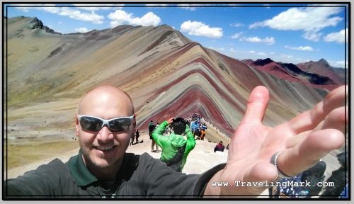
Photo: Rainbow Mountain - I Did It!
Photo: Rainbow Mountain – I Did It!

Up until a few years ago, it was under the permanent layer of snow and ice, and nothing made it special or attractive. But as the snow receded, it uncovered the mountainous formation dyed in various shades, product of the complex combination of minerals.

Despite its local name of the Mountain of Seven Colors, according to the information provided by our tour guide, the scientists identified five colors on the slopes and the summit of the Rainbow Mountain – red, purple, green, yellow, and pink – all deposited the base color of the mountain itself.
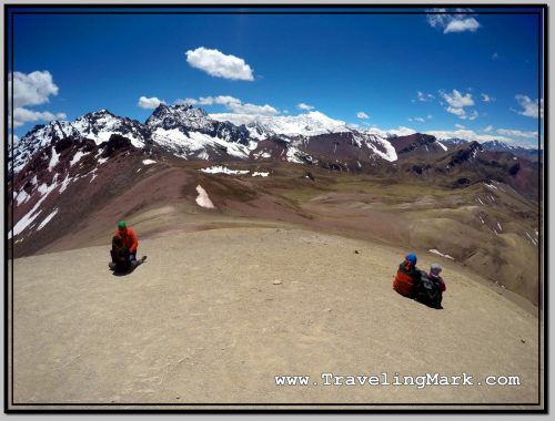
Photo: Ausangate Sacred Mountain Gave Rise to the Popularity of the Rainbow Mountain

Had you visited the Rainbow Mountain prior to 2016, you would likely be the only one hiking the high altitude trail to its 5,200 meter above the sea level summit. However because it is located on the way to the imposing Ausangate – the snow-covered mountain with an elevation of 6,384 metres – adventurers who dared to ascend Ausangate in 2016 took photos of Vinicunca which they then shared on the social media, sparking the interest in the mountain. Since then, the popularity of the Rainbow Mountain exploded and now it receives hundreds, if not thousands of visitors a day, making it one of the most visited places in the Cusco region of Peru – along of course with Machu Picchu.
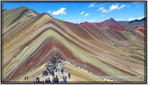
Photo: Trail to the Rainbow Mountain Was Littered with Tourists Braving the 5,000 Meters Elevation

The road to the Rainbow Mountain is along a canyon with narrow passage carved into the steep cliffs of its sides. You have no choice but to trust your bus driver that he knows what he’s doing, with the understanding that if he messes up, you’re dead, but so is he. In other words – he has as much incentive to drive safe as you have the hope he will.
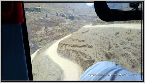
Photo: Sketchy Road Along Canyon Leading to the Rainbow Mountain

Through the whole ride there and back, I was telling myself that one day I will remember it as something crazy I have once done, and that I’m glad I did not die there, but while I was at it, I was realizing I was riding on the Grim Reaper’s tail the whole time and at any given time there were mere inches separating me from certain death. One wrong move on the driver’s part, and everyone in the bus is dead.

There was not a person on the bus who was not clenching his or her butt cheeks so tightly, you couldn’t jam a sharpened hair up anyone’s ass crack, but it was the ones sitting on the side of the bus facing the canyon who were breathless the most. The wheels on that side of the bus were gliding on the edge of the cliff, and there was a long way down. It constantly felt like you’re better off not knowing just how close you are to the edge, and just how far down it is.

Before the final ascend with the bus, we crossed the canyon over the shadiest looking wood bridge ever. That would have induced grasps for air if we were to walkover it on foot, yet we drove over it with the bus. Each of us gasped when we did it. Damn!

Shortly after the bridge, we stopped at the toll booth where our guide paid for everybody’s entrance and our vehicle drove to the parking area, from where we commenced the hike. There were several other vans used as tour buses parked up there, suggesting a high number of hikers on the trail.
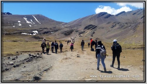
Photo: Long High Altitude Trail to the Peak Overlooking the Rainbow Mountain

Locals with horses were offering an option to reach the mountain without straining your heart and lungs, and a number of locals including children were stationed along the trail, selling heavily overprices snacks and beverages, including coca tea for altitude sickness. I asked one horseman how many times he ascends the mountain on an average day, he told me that he does it twice – impressive physical fitness in those people.
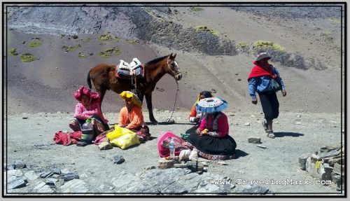
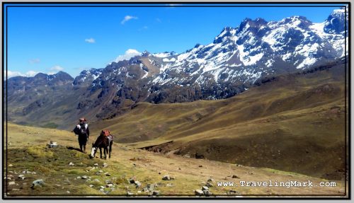
Photo: Until Visitors to Rainbow Mountain Were Able to Hire Horses Lead by Locals in Traditional Costumes

The trail offers spectacular views along each step. There are mountain peaks in every direction, some tall enough to be permanently under snow cover. In places you notice the glaciers giving way to mountain lakes, which then trickle down as creeks that carve out the canyon.

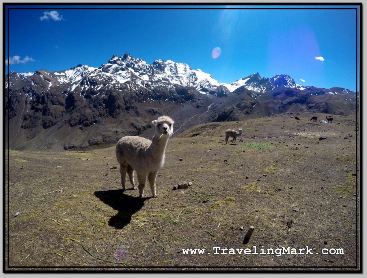
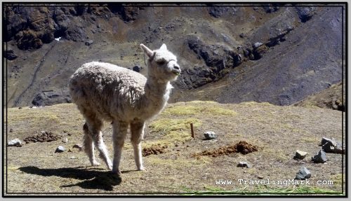
A number of domesticated llamas and alpacas are encountered along the trail.
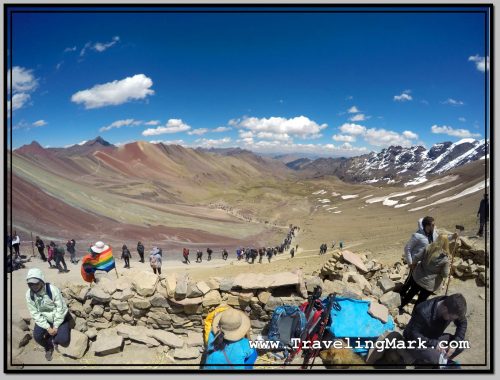
Photo: Long and Strenuous Hike Up the Rainbow Mountain

The hike itself is rather strenuous, but no part of it is overly dangerous. It starts easy with there being only a slight incline, but it keeps getting steeper the further up you get. If not for the altitude, the trail itself would likely not be such a challenge. But it was the altitude that made everyone daring the trip work for it.
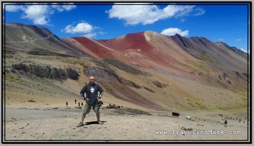
Photo: Red Valley Is Adjacent to the Rainbow Mountain

I myself felt like my muscles definitely had what it takes to get up and down the mountain, but the heart and the lungs were getting a heavy work out. The final approach toward the Rainbow slope was the steepest, so ascending that really tested my respiratory system’s strength and endurance. You could see on everyone’s face how hard of a time they were having taking each step further.
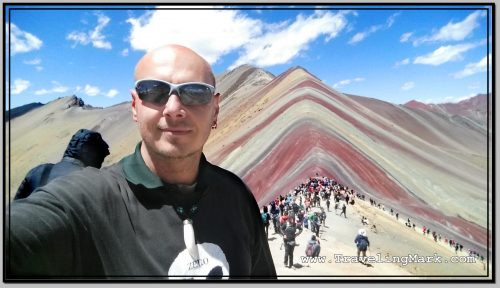
Photo: Standing on the Outcrop Adjacent to the Rainbow Mountain

Taking frequent breaks was unavoidable. Everybody was taking them. Only the ones who took the easy way by hiring a horse passed by us with ease, but even for them keeping their breath up was not so easy. But for us who were also under physical strain, for us the challenge was real.
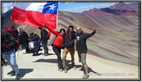
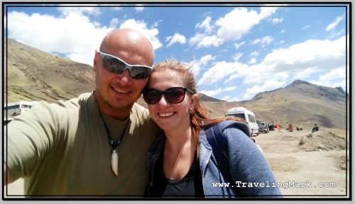
Photo: On Top with Chilean Couple

It was for these reasons why once we reached the top, we were giving one another hugs and were celebrating together like we’ve just achieved great victory. Because we all did. We won over ourselves. We faced a personal challenge and we pushed through. The feeling of unbelievable achievement is difficult to describe. It has to be experienced. It’s hard to climb the Rainbow Mountain. It’s really hard, but if you fight through it regardless, and keep going even after your body has told you a million times it wants to quit, you’ll experience the feeling of achieving what you did not think you were capable of, and that feeling is incredible.
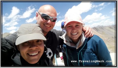
Photo: Smile You Wear After Pushing Yourself Into Succeeding

The access to the Rainbow Mountain itself is prohibited, apparently with the intent to preserve its delicate surface. From the foot of the Rainbow Mountain, one can continue up to the outcrop from where there are the best views of the mountain colored slopes. The top of the outcrop, named Montana Winikunka, is at the elevation of 5,036 meters above the sea level. That is just a little lower than the Mount Everest base camp.
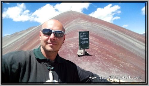
Photo: Sign Prohibiting Access to the Rainbow Mountain

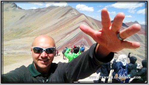
This was the first time in my life to have climbed to the altitude in excess of 5,000 meters and having achieved that felt amazing.
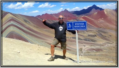
Photo: Mountain Winikunka - First Time in My Life Climbing to More than 5,000 Meters Above Sea Level
Photo: Mountain Winikunka – First Time in My Life Climbing to More than 5,000 Meters Above Sea Level

From the Rainbow Mountain, an option exists to detour to the Red Valley, but this was not included in the tour I took. The combination of the two is usually done as a two day tour with a camping stay overnight on the mountain.
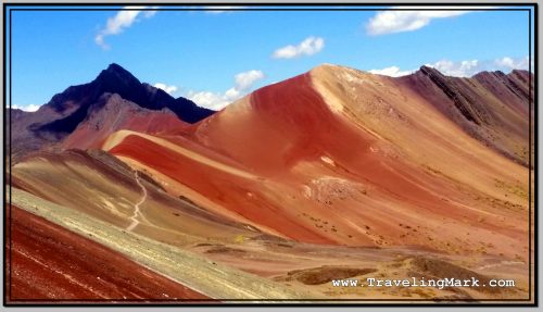
Photo: Rugged Red Valley with Slope of Rainbow Mountain in Bottom Left

What the future holds for the Rainbow Mountain is anyone’s guess, at this stage. The locals have been milking the living hell out of the high popularity that’s exploded over the past couple of years, but on March 16, 2018, a mining concession was made to the territory where the mountain is located. The Geological, Mining and Metallurgical Institute of Peru handed over mining rights to the Canadian mining company Camino Minerals. I’m glad I got to experience the mountain before heavy machinery rolls in and the are is turned into a mining ground.
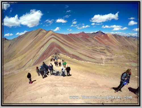
Photo: Climb Up the Rainbow Mountain - What an Experience
Photo: Climb Up the Rainbow Mountain – What an Experience

With all its ups and downs, he Rainbow Mountain became the best place I visited during my stay in Peru. Unfortunately, it was followed by the worst – the trip to Machu Picchu.

Here’s a short video from the hike and the joys of having reached the top:
Buying Rainbow Mountain Tour in Cusco While Staying at El Viajero

Having concluded my weekend in Lima, I returned to Cusco. The 22 hours long bus ride seemed as neverending as when I went the opposite way.

Instead of going back to Hostal Margarita where I stayed when I first visited Cusco, I however decided to try out El Viajero Hospedaje, because it was close to the bus terminal. I quickly came to regret the decision.

El Viajero

The room at El Viajero cost 30 Soles, the same as at Hostal Margarita, but to my shock, after an hour of stay, the owner switched off the wifi router, shutting off the internet for me.

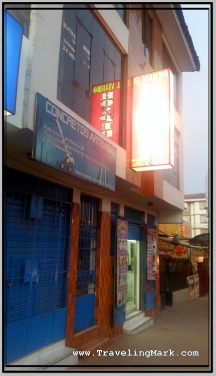
Photo: El Viajero Hospedaje in Cusco, Peru - I Had to Get Up at 4am but Waited 2 Hours for Tour to Rainbow Mountain to Arrive
Photo: El Viajero Hospedaje in Cusco, Peru – I Had to Get Up at 4am but Waited 2 Hours for Tour to Rainbow Mountain to Arrive

When I confronted him about it, he said I’ll only get an hour of internet, and if I want more, I would have to pay for it. I quickly said I’m canceling my stay there and demanded my money back, because before moving in, I had done what I always do with every single place before I pay for a room – I asked whether the rooms come with free wifi internet. Whereas he confirmed I’d get free internet with the room, I agreed to stay there, so now that he was changing the rules after the game has started, I was having none of his crap.

With unshakeable determination I told him I demanded my money back and proceeded to pack up in order to immediately leave. After that, he said he’s gonna turn the internet back on for me, although after a few hours, he turned it off once again.

That sparked another argument from me, until he eventually agreed not to turn it off again.

Booking Tour to Rainbow Mountain

Meanwhile, I went out to find out what it’d cost to book a tour to the Rainbow Mountain. I have never heard of the Rainbow Mountain before (known locally as la Montana de Los Siete Colores – the Mountain of Seven Colors), but it was strongly recommended way back after I had just landed in Peru, and hang out in downtown Lima with Isadora from Brazil.

Photo: This Is Emma, She Is British, We Climber Part of the Rainbow Mountain Trail Together

I went to a few tour operators in Cusco and enquired about the prices for the Rainbow Mountain. While there were some overpriced options, general cost seemed to be in the neighborhood of 60 Soles for the trip, including the 10 Soles entrance fee (Peruvians milk tourists every chance they get, so every time there is a new attraction, they instantly introduce an entrance fee).

Several tour operators advertised what they promoted as a great price for the trip to the Rainbow Mountain at 50 Soles, but that was just a marketing gimmick, because unlike the regular 60 Soles worth tours, the 50 Soles ones did not include the 10 Soles entrance fee so the end cost for the unaware tourist would in the end be the same anyway. It would appear that the deceptive marketing works out well, because in the tour bus I took, all but two people fell for it, thinking they got a better deal.

Photo: Alpaca Calmly Grazes on Grass Along the Trail to Rainbow Mountain

The Rainbow Mountain tours start early in the mornring. The include pickup from the hotel and I was told to be ready for my pickup at 4:30 am. Whereas the tour would last whole day, what it meant for me was that I would have to leave my room at El Viajero with my backpack, because there was no way I was staying there for another night

I would have preferred to have stayed in a reasonable place where I would have been able to leave my baggage while I’m up on the mountain, but El Viajero simply wasn’t that place, so I had no option but to haul all my crap with me, so I can book me a room elsewhere after I’ve returned from the Rainbow Mountain. Standard check out time in Cusco is ridiculous 10am. The return from the Rainbow Mountain was not expected until 5pm.

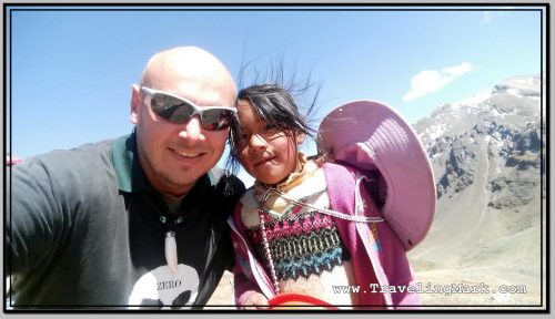
Photo: Indigenous Girl I Met on the Way to the Rainbow Mountain

As is also pretty standard with tours in Peru, even though I got up at 4am in order to be ready for the pickup at 4:30 as per the instructions I got, the tour bus didn’t show up to pick me up until 6:30am. I would have gotten 2 hours more sleep, had they been up front with me that nobody’s gonna bother picking me up nowhere near on time. After my previous experience booking a tour in Peru, I should have known better.

Food Included

The Rainbow Mountain tour also included breakfast and lunch. As is almost always the case, each time the tour comes with a meal included, you’d be better off paying less for the tour and not have it included, and either bring your own sustenance with you, or pay for your own food along the way.

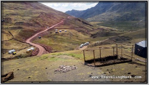
Photo: Drivable Section of the Road Leading up to the Rainbow Mountain Trail

The included food is in a restaurant that pays the best commission, and it’s mass produced to maximize profit. I was told it would be a buffet style service, but all there was for the breakfast buffet were a few baked breads with butter and jam, plus a cup of tea. The latter was the only thing I used, as pure carbohydrates with no nutritious value of the rest did not attract me at all. Luckily, as far as the tea was involved, the restaurant did provide coca leaves, which are known for being beneficial when braving high altitude, and give the drinker a bit of an energy boost.

The lunch, which was served in the same restaurant on the way back from the mountain, was not a big win either. A tray of rice, a tray of a bit of chicken, a plate of lettuce and a pot of soup were provided, but there was so little of each, by the time one half of the bus filled up their bowls with soup, there was none left, and likewise, with the exception of rice of which there seemed to be enough, only the first ones at the tray of chicken got a reasonable portion.

Photo: Restaurant Was Not Much, But Mountainous Scenery It Was In Was Breathtaking

Basically, for my breakfast buffet I got a cup of coca tea, and for my lunch buffet I got a scrap of chicken with a small side of veggies and that was it. The jugs of juice that accompanied the lunch were filled with some syrup water loaded with sugar.

Other than that, the trip to the Rainbow Mountain itself was amazing. For me, it counted as the best experience I have had in Peru, mostly because it was the first time I climbed to over 5,000 meters above the sea level and even though it was tough on my body, I pushed myself and battled through the low oxygen environment and did it. The feeling of accomplishment was amazing, as were the views of the spectacular mountainous scenery.

Photo: Those Not Fit Enough to Hike Up the High Elevation Trail, Can Use Services of the Many Horsemen with Horses

Just as Isadora strongly recommended a trip to the Rainbow Mountain to me, I also strongly recommend it to anyone visiting Peru. It’s a high altitude hike so it’s not a walk through a park, but if you push through and reach the top, the reward will be very much worth it.

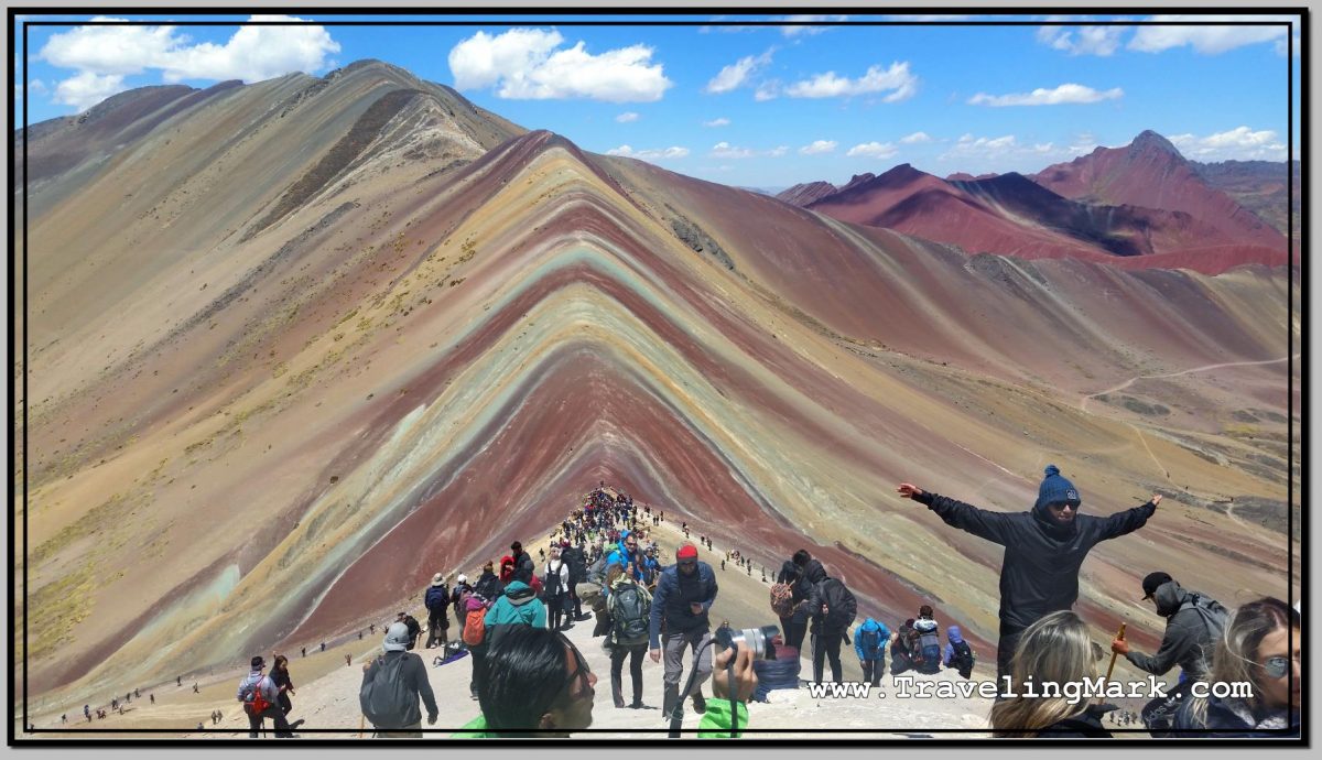
Photo: Rainbow Mountain - Hell Yes I Did It!
Photo: Rainbow Mountain – Hell Yes I Did It!

Bus Trip from Puno to Cuzco

After returning from the trip to pre-Inca ruins at Sillustani, where the sun was frying the visitors alive, I found myself back in Puno. I had my half trout meal for 8 Soles, and went to wait for the bus to Cusco (interchangeably spelled “Cuzco”) at the terminal.

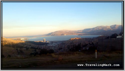
Photo: The Last Picture of Puno and Lake Titicaca I Took Before Leaving

Scheduled to leave Puno at 10pm, I had to withstand 4 hours of bone-chilling nighttime after the sun set at 6pm, before I got on the bus. Luckily, I had a pretty good seat, but was unfortunate to have a snorer right behind me. He made everything worse when he took his shoes off and his stinky socks turned the entire couch into a gas chamber for the rest of the trip.

We arrived in Cusco at 5am. The 7 hour journey was nothing fun, but was not that bad. Cusco, being also at high elevation, is likewise cold at night, but nowhere near Puno cold. I waited at the bus terminal until 6am, so I could walk the streets in search of a hostel during daylight.

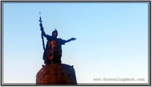
Photo: Bronze Statue of Inca Chieftain Near Bus Terminal in Cuzco

A friend from Lima recommended me to check out Pariwana Hostel, so I looked it up on a map and headed there on foot. It took me about 30 minutes to cover the distance from the bus terminal to the downtown area, only to find out that Pariwana is unreasonably expensive for my taste, with beds in dorms shared among 12 people costing 35 Soles (around $10 US), while a room with a matrimonial bed cost 185 Soles (around $56 US) per night.

Similar to Miraflores in Lima, these are the type of prices I’d expect to see in Western Europe, not in South America. I turned on my heel and headed back down the streets in search of something more economical.

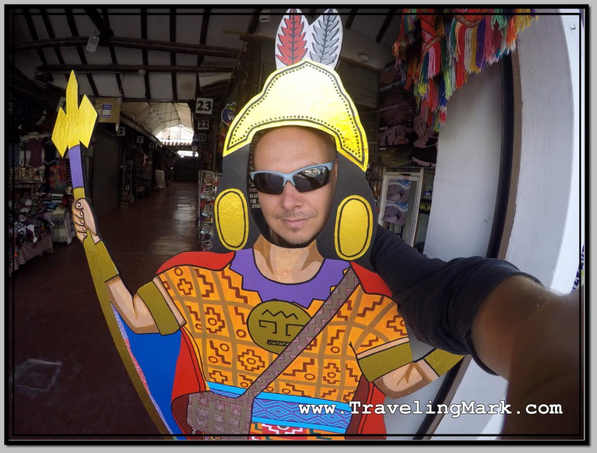
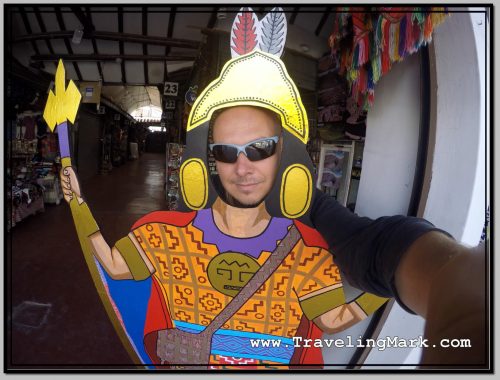
Photo: Selfie as Inca Warrior

Eventually I booked a room in Hostel Margarita located on Avenida El Sol, which is the avenue leading all the way up to Plaza de Armas. At a cost of 30 Soles per night I was happy with the room, even though it did not have a private bathroom and the shared bathroom had no doors, so anyone could walk in on your showering at any time, and there was no toilet paper at all provided for use by the guests.

The hostel was also being repainted from the outside, so there was a lot of construction site type noise, but that only lasted during the day. At night, the hostel was reasonably quiet and I was able to get much needed sleep. I also liked that after truly freezing nights in Puno, the night in Cuzco, albeit still cold, was significantly less cold so I did not spend the entirety of it shivering.

Tour to Sillustani Pre-Inca Ruins Outside Puno

While my first night in Puno was plagued by cold and noise, the second one was just cold. But it got really cold. It was reasonably quiet in Hotel Inka Tours, which I desperately needed, but as the wind picked up at night, it got so cold, I could not stop shivering.

I concluded that I simply am not equipped for stay in such a cold place, and made the decision to leave after the second night. Puno was colder than I expected and I simply did not have warm enough clothes to handle the relentlessly cold nights.

I checked out of Hotel Inka Tours at 11am and headed for the bus terminal where I purchased a ticket to Cuzco on an overnight bus. Whereas several providers offered these trips, I specifically asked each one if they would hold my luggage until the bus’ departure at night, so I can go out and do some more exploring during the daytime.

Company Mer was happy to store my luggage until the departure so I bought the ticket with them, and proceeded to make arrangements to get me to the archeological complex of pre-Inka ruins at Sillustani.

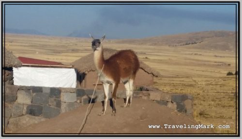
Photo: Lama Used as a Lure in Front of House on Way to Silluani to Attract Tourist and Charge Them for Photos

Located on the shores of Lake Umayo in the Umayo Atuncolla district of the province of Puno, the near 40 kilometers long journey to the archeological site involved a bus to the access road from where I took a taxi to cover the last few kilometers.

Having passed by a number of traditional houses with llamas in front of them to attract tourists and charge them for taking pictures of the animals, I found myself at the entrance to Sillustani, which was likewise turned into a tourist trap with numerous sellers of overpriced handicrafts and high-cost bottled water. The use of bathrooms was also one of the most expensive in all of Peru. The entrance fee to the complex was 10 Soles.

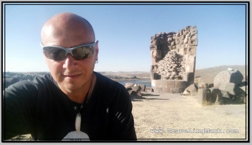
Photo: Selfie at Lizard Chullpa

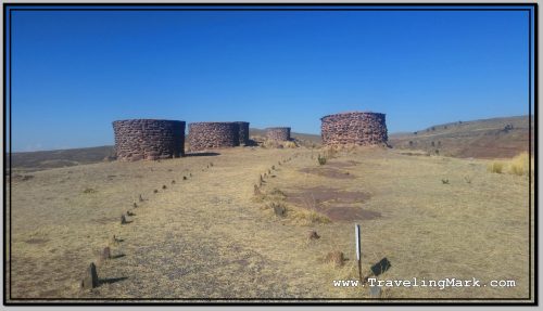
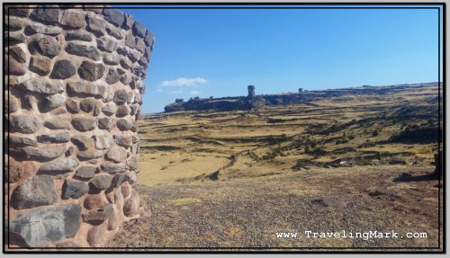
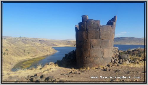
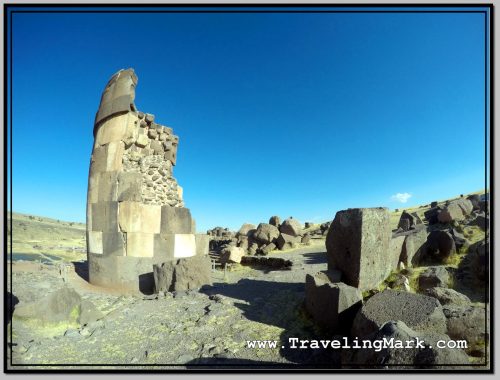
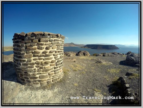
Sillustani was used as a necropolis and is littered with “chullpas” – funerary towers built on the hill overlooking the Umayo lagoon. The location with breathtaking views of the lagoon would make for a captivating trip even if archeological sites are not your thing.

Chullpas of Sillustani

The chullpas are tower like structures built as tombs by the Qulla people, a subgroup of the Aymara indigenous nation, before they were conquered by the Incas, and later by the Spanish.

Photo: Set of Older Chullpas at a Further End of Sillustani

The majority of chullpas at Sillustani are circular and made of stones. In some, the archeologists found mummified bodies particularly well preserved thanks to the cold and dry climate of the Altiplano. The tombs also held ceremonial objects in gold, although the majority is believe to have been lost to grave robbers.

Photo: View of Lizard Chullpa from Location of More Remote Chullpa

All Chullpas have a single, small door facing east. This direction has been symbolically chosen to represent the rebirth of the soul through the sunrise. The oldest Chullpas are said to have been built by the Pukara civilization at around 800 BC.

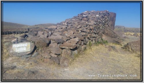
Photo: Ramp of Rocks Is Presumed to Have Been Used to Get Large Stones on Top of Chullpas

They are spread out across the hill, so even though I kept a decent pace without pausing for too long at any one structure, it took me an hour to get to all the main ones.

Lake Umayo

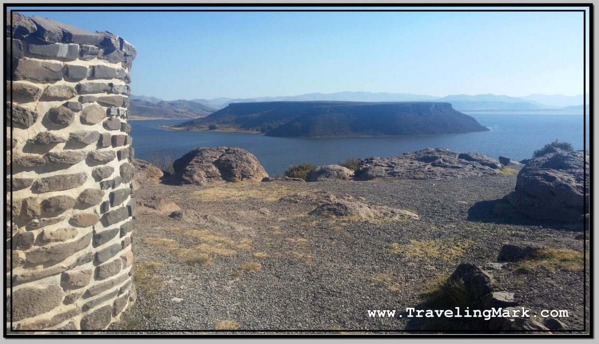
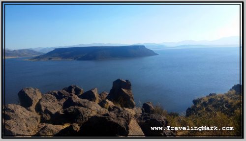
You can see the marshy side of Lake Umayo as soon as you enter Sillustani. But its true beauty does not reveal itself to you until you’ve climbed on top of the hill housing the Chullpas. With its flat-top island in the middle and steep cliffs on the fringe, the lake truly rewards the visitor braving the high elevation climb to Sillustani.

Photo: Flat Top Island on Lake Umayo

The 125 hectares large Umayo Island is called Intimoqo by the locals. There are diverse legends surrounding Laguna de Umayo, such as the one that says that its water is saltier because it is the tears of the princess Ururi, who poured them when losing her beloved. In the face of so much pain the Sun hid and there were years of drought and hunger, until their parents guilty of the drama, implored the return of the Sun, but their tears also arrived at the lagoon, making it saltier. After the return of the Sun, only the time and the less suffering of the people made it less salty, so that the fish returned and procreated.

Photo: Partially Collapsed Chullpa with Laguna de Umayo in the Background

What to Expect

The highest point of the area, according to the information I got from the locals, stands at 4,000 meters above sea level, which is a significant elevation so one should take precautions against possible altitude sickness. Having been built on a hill, the walking around Sillustani involves a lot of uphill trekking that is sure to get your heart pumping and lungs gasping for more air.

Photo: Lizard Chullpa Is The Most Iconic

When I was there, the sun was blasting something intense, so making sure you put on sunscreen before heading to Sillustani. At that elevation you have 4 kilometers less of dense air blocking the sun rays compared to the sea level, but even though the temperature would not suggest it, the intensity of the rays is savage despite seeming that way.

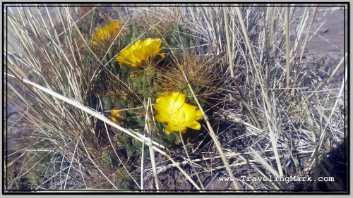
Photo: Flowers Like This Surrounded with Thorny Spokes Can Be Found on Sillustani Hill

A light jacket would also come in handy as once you reach the top of the hill, the wind really picks up. I did in in just a long sleeve shirt and was fine, but the biting wind would have been too much for a short sleeve.

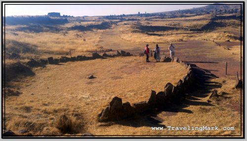
Photo: Intiwatana - Ceremonial Circular Structure Build by the Incas
Photo: Intiwatana – Ceremonial Circular Structure Build by the Incas

Overall I found Sillustani overly touristy. The ancient structures were interesting, but for me the highlight were the views of the lagoon surrounding the hill on which the chullpas were built. Make sure you bring your own bottle of water so you’re not left having to buy the overpriced small bottles sold in the local shops lining the sidewalks of the village.

Photo: Chullpa with Umayo Island Inside the Lagoon

Battling High Altitude in Puno

Having checked in late at night, once I woke up from the cold night at El Lago Hostel, I went out into the sun filled streets of Puno to unfreeze my bones from the shivers dominated night. The first goal was to find a different hostel to move to, as El Lago simply did not provide reasonable value for the price, and the incessant, night-long screaming made any chance of a restful stay an impossibility.

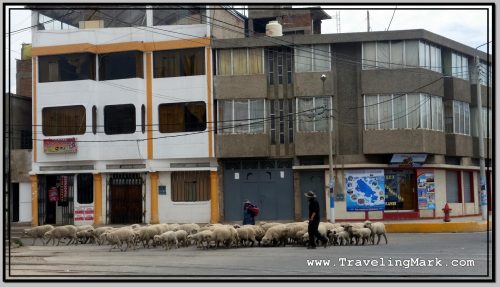
Photo: Sheep Herder Takes Up Morning Road in Puno, Peru

I moved to Hotel Inka Tours. Not only was the price for the hotel 35 Soles, ie less than at El Lago Hostel, the room was much nicer, the bed more comfortable, the bathroom cleaner, the internet worked and the staff did not make the common area of the hotel a party place for the night.

With the new room for the upcoming night secured, I moved my things over and headed out to the streets of Puno to battle the city’s high altitude on foot.

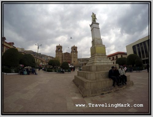
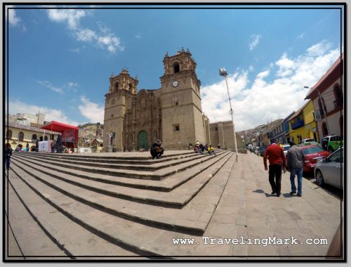
Photo: Plaza de Armas in Puno with Cathedral in the Background

Plaza de Armas (every city in Peru appears to have a downtown square called Plaza de Armas), was over 2km from the bus terminal near where I was staying, so it took a bit of a nice walk through the city to get there and snap a few pictures of the cathedral and the nearby buildings.

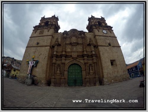
Photo: Basílica Catedral de Puno

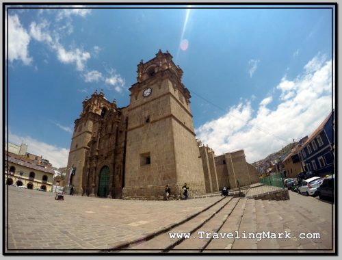
On the upper side of Plaza de Armas proudly stands the Cathedral of Puno, also known as the Basilica of San Carlos Borromeo. The baroque cathedral is the main church in the city of Puno. It is under the ownership of the Catholic Church, and was declared a Cultural Historical Heritage of the Nation of Peru in 1972.

Photo: Iglesia de San Carlos Borromeo in Puno

The cathedral is made entirely of stone. The idea for a cathedral of stone reportedly arose from a miner from the area called Miguel de San Román. Indigenous master Simon de Asto was put in charge of building the cathedral – a construction that ended on May 25, 1747.

Photo: Catedral de Puno, Otherwise Known as Basílica de San Carlos Borromeo

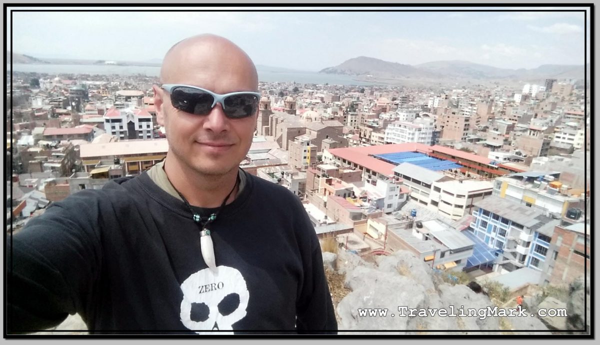
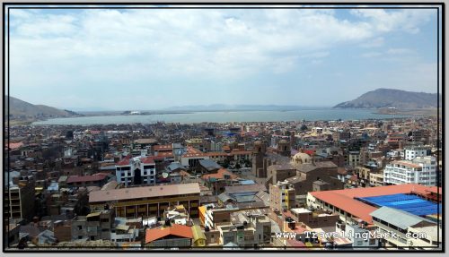
From Plaza de Armas, I headed up on the nearby hill on top of which I saw a statue. The unobstructed views from the hill promised opportunities for pictures of Lake Titicaca and the city of Puno itself.

Even though reasonably fit for long walks, ascending the 60 meters high rocky outcrop known as Cerrito Huajsapata in the altitude close to 4 km (3,839 meters above the sea level) was no chore. The shortness of breath was a frequent reminder that I have just arrived in this elevation and my body is not used to it yet, so I need to keep that in mind and take things easy.

Photo: View of Lake Titicaca from Cerrito de Huajsapata

Moreover, kind of like express kidnappings are a well documented threat in Arequipa, Puno is known for its hills being locations of frequent armed robberies of foreigners, so heading up to any of the lookouts is a potential risk for every tourist.

I decided I would not be risking it to the higher hills further out, and will be happy with the one nearest downtown so I don’t end up robbed or worse.

Photo: Police Stationed on Cerrito de Huajsapata

Luckily, the uphill climb in the high elevation city was the only challenge I encountered. As a matter of fact, once up, I saw three policemen nearby, giving the impression of the city having been aware of the bad rep its lookout hills are getting and began stationing police in some of the more popular ones.

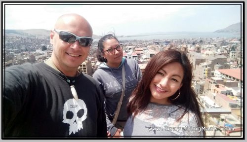
Photo: Met These Peruan Girls on Cerrito de Huajsapata

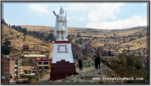
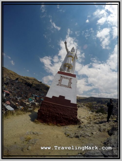
The information sign at Huajsapata Hill stated that Huajsapata is the Quechua word meaning “the highest part of the crag“. The statue on top of the hill is of Inca Monco Copac, the founder of the Inca Empire, who according to legend, was commanded by the Sun God to emerge from the waters of Lake Titicaca.

Photo: Statue of Manco Capac on Cerrito de Huajsapata

The ancient inhabitants of the high plain known as the Altiplano believed that the underground caves beneath Cerrito Huajsapata led to the Koricancha Temple in the city of Cuzco.

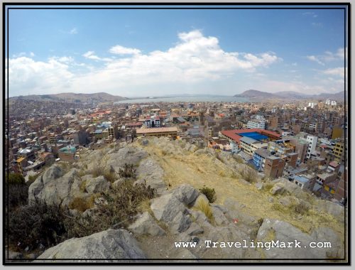
Photo: City of Puno and Lake Titicaca Seen from Huajsapata Hill

Overall, I enjoyed exploring Puno on foot, and although I didn’t suffer any of the more severe symptoms of altitude sickness, the high altitude of the place made breathing a challenge at every step and even the lightest physical activity resulted in quick shortness of breath.