Road Blockages to Prevent Tourists from Getting to Machu Picchu

When I was charged for the full journey of being taken from Ollantaytambo all the way to Hidroelectrica, the roadblocks along the way that halted the traffic mid way through have been in place for a whole week.

During that entire week, the same travel agencies have been charging tourists for the full lengths of the journey, while lying them into their faces that they will be taken all the way to Hidroelectrica, despite being fully aware that none of the tourists who had bought that trip anytime within the week proceeding my trip got to the destination.

Similarly, the same vans have been taking tourists mid way, knowing full well that none of them will be taken all the way to Hidroelectrica, but lied to every single one through their teeth that they are getting to Hidroelectrica, even though they knew full well that the road blocks remain in place and none of the previous trips during the week have delivered tourists to the destination.

Had I been hinted by either the travel agency or the van operators that there have been road blocks for a week on the way to Machu Picchu, and there is pretty much no chance a vehicle can get to Hidroelectrica (the place nearest Machu Picchu that’s accessible by a motor vehicle), I could have easily postponed my trip until the protests have ended and the road become drivable again. But I guess it’s outlandish to expect honesty from Peruvians when they smell the dough.

Peruvians Hate Tourist, But Love Tourists’ Money

Peruvians love milking tourists on every step with entrance fees to every little corner that garners any kind of interest. But at the same time hate the tourists enough to make their life difficult simply for coming to Peru to spend money they earned abroad on the local economy.

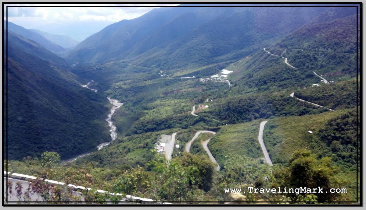
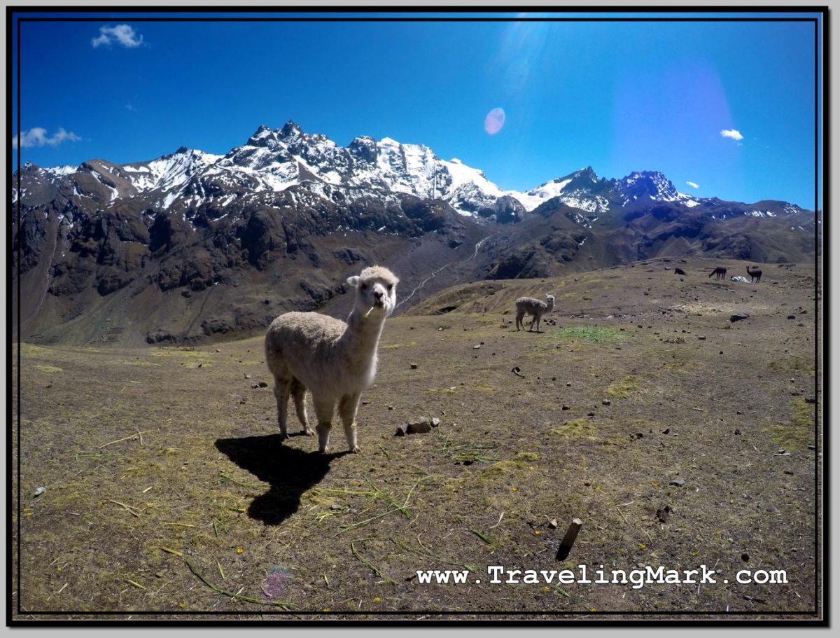
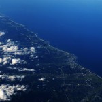
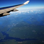
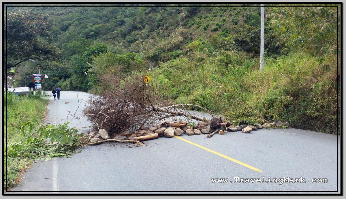
Such was the case of roadblocks on the way to Machu Picchu. Knowing the road passing through their villages is the only access road to Machu Picchu, the communities of Amaybamba, Huyro, Huayopata, Santa Maria and San Pablo set up roadblocks in order to make access to Hidroelectrica by car impossible.

Photo: Rocks and Trees Used as Road Blocks to Prevent Tourists from Reaching Machu Picchu

Hundreds of tourists who refuse to support the rip off practices of the Peruvian government who charges foreigners upward of $480 dollars for a train trip to Aguas Calientes (the town at the foot of Machu Picchu) for which the locals pay 10 Soles (about $3), opt to hire a vehicle to Hidroelectrica, from where it is a little over an hour on foot to Aguas Calientes, as the more economical, albeit more tiring option
of reaching Machu Picchu.

Even though the economy of every single one of these villages immensely benefits from the fact that they did nothing to deserve it, but are geographically close to Machu Picchu so the hoards of passing tourists often stop to buy a drink, a snack or cooked food from a restaurant, or stay a night in hotels where available, they are still ungrateful for it and their way to protest when they wish to demand something from the government is by making life difficult for said tourists.

Were their locations not so close to Machu Picchu, there would be nothing to attract so many tourists through their villages, so any kind of a road block would not have an impact. But hey – since they are close to Machu Picchu, who not make life for the economy supporting tourists difficult?

Can you think of a more unworthy people to spend your hard earned money on while traveling?

Long Walk to Santa Teresa

The van that promised to deliver us to Hidroelectrica dropped us off somewhere outside of Amaybamba. The driver simply told us this was the end of the trip for us, and we needed to get off his van and if we didn’t like it, we’ll have to bring it up with a travel agency that sold us the trip and sort it out with them.

The worst thing was, that whole area around Machu Picchu is infested with biting midgets. We got thrown out of the van and instantly got swarmed and attacked by these tiny, quarter of a fruit fly sized insects that rip a hole into your skin with their razor sharp jaws to lap blood as it oozes out. Unlike actual mosquitoes, these super-tiny insects are near invisible so you could be getting bitten by three dozen of them at the same time and never notice until it’s too late and your legs itch like mad.

Unfortunately, the van driver didn’t even offer us an option to return to Ollantaytambo. He just dropped us off in the middle of nowhere, none of us knowing where we were, and told us to help ourselves any way we could.

Another bad thing was that the locals not only demanded concessions from the government by making life difficult for tourists, but were also openly hostile toward tourists who had no other option but put their backpack on and cover the second half of the 4 hour long vehicle trip on foot.

I have never before visited Machu Picchu, and was thus under the disillusion that the place was worth it, but one way or the other I didn’t really have many other option, so I joined the rest of the confused tourists, and put my backpack on to keep moving forward on foot.

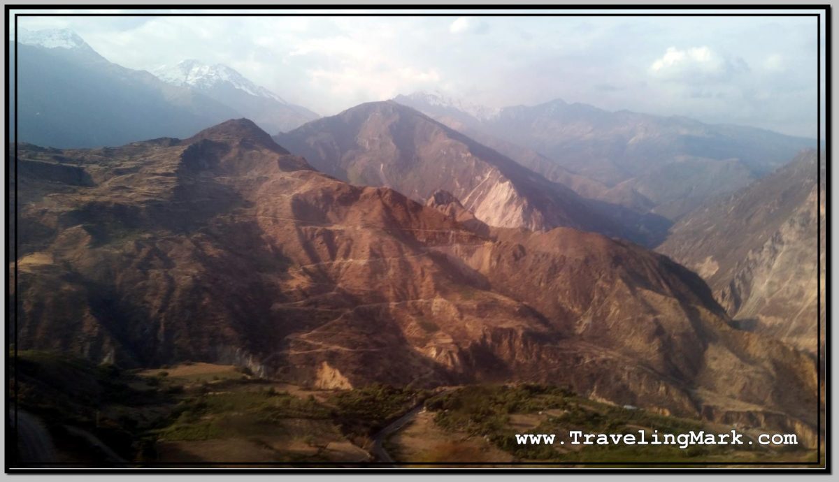
The slight positive at the time was the fact that the road from where we were, at least as far as Santa Maria, the first village on the way big enough to have hotels, was downhill. That was however only of relief for the day, because it came with the understanding that if the road blocks were not removed by the time I need to go back, then I will be walking the same distance up hill.

There were in fact many tourists we came across who walked the opposite way. Some of them got to Aguas Calientes before the roadblocks were set up, so they only had to do the extra walk returning, but even so, the return trip was vastly up hill which made it very strenuous.

Photo: Line of Cars Stuck at Road Block as Hostile Locals Watch

What kept most of us alive at the time, was the deliberately misleading information that the roadblocks are only as far as Santa Maria, and that from Santa Maria we’ll be able to catch a colectivo (a taxi that serves as a local transport which leaves when full) to Santa Teresa, and then from Santa Teresa another colectivo to Hidroelectrica.

Of course, that would be an additional expense to get ourselves to Hidroelectrica even though we each have already paid for the trip all the way to Hidroelectrica, but hey… this is Peru.

Needless to say, finally arriving in Santa Maria after more than 2 hours on hiking with backpacks on on an open road without a shade as the intense sun kept blasting on us felt amazing. But the feeling was short lived.

More Lies

There were no colectivos out of Santa Maria for Santa Teresa, because the road between Santa Maria and Santa Teresa was also blocked.

At that moment, I finally realized what I should have realized a long time ago – Machu Picchu is simply not worth it. I should have turned on my heel when the van dropped us off and somehow hitchhiked my way back to Ollantaytambo.

But by the time I arrived in Santa Maria, I was already way too invested in the trip to turn around and track back uphill.

In Santa Maria, the paved road ended, so the rest of the walk was on a dirt road covered with rocks. There was a fell tree used as a roadblock about a quarter way through.

Photo: Fell Tree Used as Road Block on Dirt Road Between Santa Maria and Santa Teresa - Drivers Tried to Remove It with an Axe
Photo: Fell Tree Used as Road Block on Dirt Road Between Santa Maria and Santa Teresa – Drivers Tried to Remove It with an Axe

That day, I was mentally prepared for an hour long walk from Hidroelectrica to Aguas Calientes. Had everything gone the way it should have, I would have arrived in Aguas Calientes in mid afternoon, which would have given me enough time to find a room before dark.

But after arriving in Santa Maria, it became clear that I will not make it to Aguas Calientes by daylight. Luckily, unlike most other tourists stranded in the same way, I did not have a room booked beforehand in Aguas Calientes, so for me the option existed to either stay in Santa Maria or Santa Teresa.

When it all hit me about how unworthy Machu Picchu is, I played with the idea of staying the night in Santa Maria, and doing the 3 hour uphill walk back to the last road block to hitch a ride to Ollantaytambo with someone, but somehow got influenced by a disillusion that perhaps in the end, Machu Picchu will be worth it. So I carried on to Santa Teresa.

But whereas by the time we got to Santa Teresa it was already getting dark, if I were to make it to Aguas Calientes the same day, I would have to hike through the unlit forest trail at night, I made a decision to spend the night in Santa Teresa, recover a bit from the unplanned strain in the sun and do the hike to Aguas Calientes during daytime the following day. All other tourists from the group with which I walked however already had their rooms in Aguas Calientes pre-booked, so all of them carried on.

Trip to Machu Picchu – The Worst Experience in Peru

After I’ve concluded the exploration of Inca ruins in Ollantaytambo with the walk to the remnants of the Inca bridge and the nearby pyramid, I returned to Plaza de Armas to find out about the means to advance on my way to Machu Picchu.

I ended up buying a van ticket from Ollantaytambo to Hidroelectrica for the following day. Hidroelectrica (hydroelectric power station) is as close to Machu Picchu as it’s possible to get by car. From there, one must walk around 6 kilometers down a rocky path along the railway tracks to get to the town of Aguas Calientes – a town set up at the foot of the mountain housing Machu Picchu for the purpose of accommodating the trows of tourists visiting the Lost City of the Incas.

Photo: Beautiful Mountainous Scenery Encountered on the Way to Hidroelectrica from Ollantaytambo

I bought the ticket to Hidroelectrica from a woman with a small child in an agency with the office located just off the north-west corner of Plaza de Armas for 40 Soles (just over $12 US). I asked about all the various options they had on offer, and chose the one for 40 Soles because I was assured that this is the only option that will get me as close to Aguas Calientes as a car can get. All other options only went to the towns of Santa Maria or Santa Teresa, which were options for those who wished to explore said towns before continuing onward to Machu Picchu.

The van was scheduled to leave at 8am in the morning, so I headed back to the room in Inka Wasi in order to prepare for the morning departure from Ollantaytambo.

Photo: Freely Roaming Alpacas Can Be Encountered on the Way Up the Canyon

10 minutes before the scheduled departure I showed up in the agency as per the instructions I was given, only to find out that the woman who sold me the ticket was not there, and the guy who was, was too busy dealing with his own clients to pay me any kind of attention.

By the time 8am arrived, I was pretty nervous, but then the single mother showed up, along with her kid, and escorted me to the van. There were dozens of unmarked vans parked along the eastern side of Plaza de Armas. Each appeared to be full to the last seat. The last one in the line had one seat available. The single mother talked to the driver and told me to take my seat.

Photo: Canyon Separating Ollantaytambo from Machu Picchu Is Covered in Lush Forest

Everything about the situation seemed way too chaotic and disorganized, so before boarding the unmarked van, I very sternly insisted that the driver confirms to me that this van does goes all the way to Hidroelectrica. He assured me that I’m in the right van, and that we are definitely going all the way to Hidroelectrica.

The not so spacious van was stuffed with foreigners and their luggage. It wasn’t the most comfortable ride and it was to last 4 to 4.5 hours, according to what the single mother told me.

Ride to Hidroelectrica

Despite not being very comfortable, shortly after leaving Ollantaytambo the van ride became incredibly scenic. For the first hour, the road was winding up the side of a mountain. We kept gaining so much elevation, I kept my eye out for a sign mentioning the altitude.

Photo: Road Up the Scenic Mountain

Just before we hit the highest point of the mountain pass, there was a sign on the side of the road informing us that we are entering a cloud zone. As we kept moving upward, we finally reached Abra Malaga, where the sign said we were at the altitude of 4,330 meters above sea level.

Had I not conquered 5,000 meters two days earlier at the Rainbow Mountain, this would have been the highest above sea level I have ever been. Although in this case it would have been highly undeserved, as I was taken to the elevation by car.

Photo: The Sign Warns Drivers That They Are Entering an Area Fogged Up with Clouds

From Abra Malaga, we started a descend, and had our first break at La Convencion, where there are a number of restaurants on the side of the road for passing travelers. Owing to its proximity to Machu Picchu, the prices for everything that was on offer were ridiculously overvalued.

Photo: Rest Stop for Drivers Between Ollantaytambo and Machu Picchu

After the 30 minutes long break, we got shoved back in the van and continued with our trip to Hidroelectrica, and eventually, Machu Picchu. Or so we thought.

The Worst Experience in Peru

After two hours of the estimated four to four and a half hour ride to Hidroelectrica, the van pulled over at a gas station and told everyone to get off and continue onward on foot.

We were all in shock, myself included. I paid for the ride all the way to Hidroelectrica, but was only taken half way there. The driver washed his hands clean off all the responsibility, and simply told everyone that we each will have to call our respective agency in order to sort it out with them, if we’re unhappy.

Photo: Cloud Veil on Hills with Road

What pissed me off about this the most was the fact that I specifically asked for clarification if this van takes me all the way to Hidroelectrica twice – once when I was buying the ticket from the woman who sold it to me, and the second time when I asked the driver before I boarded the van.

Turned out, the locals from the villages on the way to Machu Picchu had a pet peeve with the government, and their way to gain requested concessions was by making the life difficult for foreigners who bring money they work hard for abroad to support the local economies of the protesters, even though none of the locals did anything to deserve it.

At the time of my trip, the road blocks were in place for a week, and both the drivers as well as the agencies selling the tickets knew about it, but lied through their teeth to everyone who paid for the trip that they would get us all the way to Hidroelectrica, while also charging for the whole trip all the way to Hidroelectrica.

Photo: Tight Bends Were the Only Way to Drive Up the Mountain Pass

And without a shred of remorse, they’d drop us off in the middle of nowhere, fully aware that this is exactly what would happen, and leave us there stranded and without options. Many of the tourists had their accommodation paid for up front (I never do that, so I was lucky not to be one of them), so for them not reaching Aguas Calientes on the day of the trip would represent significant loss. Especially if you consider how overpriced everything in Aguas Calientes is.

The trip to Machu Picchu was without a doubt the worst experience I’ve had in Peru, if not the worst overall in 10 years of traveling. In hindsight, I wish I would have turned around and given up on machu Picchu, because no part of it was worth the absolute crap I as well as all other tourists had to put up with because locals do not appreciate the support tourists provide to the area.

Unfortunately, I made the decision on the spot to walk the rest of the way, tricking myself into falling for the unworthy delusion that is Machu Picchu.

Hike Up Pinkuylluna Mountain to Ruins of Inca Storehouses in Ollantaytambo

While Ruins of Ollantaytambo are the main archeological attraction in the town of Ollantaytambo, I left them out of my itinerary, as I did many other major archeological sites in and around Cusco, because the entrance fee to those is 140 Soles ($42 US). I simply refuse to support the rip off practices of this magnitude, unless it’s something I could not, for the life of me, afford to miss out on.

Photo: Inside Pinkuylluna Warehouse Ruins

Good thing about Ollantaytambo is that on the opposite side of the town from the main archeological site, is steeply towering Pinkuylluna Mountain, on which there are multiple smaller ruins of Inca storehouses and access to those is entirely free. The only challenge is that one must climb on foot the steel slopes of Pinkuylluna Hill in order to access them. But that’s an adventure in its own right that would be worth while even if there were no ruins on Pinkuylluna. Hell yes I was up for it.

And I wasted no time. As soon as I checked in the Inka Wasi Hostal, I put on Shea Butter which I use as purely natural sun screen, and headed out to hit the slopes.

Face of Viracocha

One quickly observable feature of the Pinkuylluna Mountain is the Profile of the Inca (Perfil del Inca). Said to represent the face of Viracocha – the supreme god of the Incas, the father of all other Inca gods and the creator of the earth.

Photo: Face of the Inca Carved Into Rock Next to Storehouse on Pinkuylluna Mountain

I was told by a local that the face on the side of the mountain is not an orographic whim, but it was sculpted in the rock, and it fulfills an astronomical function related to the seasons – the cultivation cycles – illuminating itself in the solstices in a certain way.

Access to Pinkuylluna Mountain

From Plaza de Armas, enter the old town of Ollantaytambo by way of the street the nearest to the hill (rightmost when facing the old town from Plaza de Armas). Follow the narrow, cobblestone street until you come across a gate on the right hand side.

Photo: Pinkuylluna Hill Entrance Gate

The steep rock steps begin right on the other side of the gate. On the left side of the gate there is a sign informing you that you are at the entrance to the Pinkuylluna Mountain.

Climbing the Pinkuylluna Mountain

The trail up the Pinkuylluna Mountain will get your heart pumping right off the bat. Climbing the hill is basically one major cardio exercise, so by taking the hill on, you’ll get the combination of good heart workout, the best views of the town as well as the main ruins, and the ability to get up close and personal with the storehouse ruins without shelling out a dime.

Photo: Pinkuylluna Mountain Storehouses with Uneven Rock Trail

There were moments during my climb when the gusts of wind were super strong, so not only did I have to hold on to my hat, I had to carefully watch my footing on the narrow rocky trail with deep abyss on its side. If you’re a thrill seeker, you’re gonna love walking the cliff edges of the hill.

Storehouses

The Pinkuylluna storehouses, or mountain granaries, are rectangular structures perched on various parts of the Pinkuylluna Mountain.

Photo: Selfie in Front of Storehouse Ruins on Pinkuylluna Hill

Although the placement of these warehouses on top of the hill may seems strange, the fact that at that height the air is cooler and it moves faster, would help in preserving the food and keeping it ventilated. I also tend to doubt the exhausting hike needed in order to reach the storehouses would attract many would be thieves.

Photo: Main Ollantaytambo Ruins Are Better Visible from Pinkuylluna Mountain

Overall, even though challenging, I found the hike up the Pinkuylluna Mountain, and the exploring the storehouses to be a rewarding experience that was totally worth the effort.

Moreover, with the amazing views of the main Inca fortress, I was happy to be on the hill where there were hardly any other people around, and not within the overcrowded main ruins overrun with thousands of tourists.

Photo: Pinkuylluna Ruins with Town of Ollantaytambo in the Background

If you continue all the way to the top, the ever fainter trail will take you around the hill where you will find a small cave. Few people, including locals, even know about the cave.

Photo: Cave in the Back of Pinkuylluna Mountain

If you’re easily spooked, or suffer from vertigo, a climb up the Pinkuylluna Mountain may be hazardous, but in every other case I would certainly recommend it as an alternative to the overpriced and overcrowded main ruins of Ollantaytambo.

Photo: Bird's Eye View of Ollantaytambo Town with Section of Storehouse Ruins on Pinkuylluna Mountain
Photo: Bird’s Eye View of Ollantaytambo Town with Section of Storehouse Ruins on Pinkuylluna Mountain

Here’s a video of bits and pieces I filmed while hiking the Pinkuylluna Mountain. At times the wind gusts were extremely strong:

Trip from Cusco to Ollantaytambo in the Sacred Valley of the Incas

The town of Ollantaytambo is considered to be one of the most important towns within the Sacred Valley of the Incas. It is the only original Inca town that is still inhabited. Its stone streets preserve the Inca architecture combined with temples and colonial squares. Because it is on the road between Cusco and Machu Picchu, it sees a fair bit of tourists. However, Ollanta, as it is locally called, is more than just a mandatory stop on the way to Machu Picchu. The town has its own charms, and a fair bit of its own Inca archaeological sites.

Photo: Bird's Eye View of Ollantaytambo from Pinkullyuna Hill
Photo: Bird’s Eye View of Ollantaytambo from Pinkullyuna Hill

Sacred Valley of the Incas

The Sacred Valley of the Incas (El Valle Sagrado de los Incas) is one of the major tourist attractions of the Andean region of South America due to its impressive landscape, its pleasant climate, its megalithic cultural evidences and because it offers diverse possibilities for adventure trip (including the Inca Trail).

The Sacred Valley of the Incas extends along the Vilcanota River (the same river that more downstream takes the names of Urubamba or Willcamayu). It covers the area between the towns of Pisac and Ollantaytambo.

Ollantaytambo Legend

The origin of Ollantaytambo is said to begin the legend of Ollanta, a commoner who was in love with the princess Cusi Coyllor, daughter of the Inca emperor Pachacutec, who opposed their relationship.

Photo: Pinkullyuna Hill Housing Ruins of Inca Storehouses Overlooks the Town of Ollantaytambo

Pachacutec decided to punish his daughter by sending her to the house of Virgins. Ollanta tried to kidnap her but did not succeed and was forced to flee. With the passage of time, Ollanta decided to rebel against Pachacutec, causing bloody battles. the Inca emperor emerged victorious, but for his valor, decided to forgive the commoner.

How to Get to Ollantaytambo from Cusco

Vans bound for Ollantaytambo leave from a small terminal located on Calle Pavitos, three blocks due west from Avenida El Sol, down the road just a few meters up from Hostal Margarita.

Photo: Snow Covered Mountains in the Sacred Valley of the Incas

The trip cost 15 Soles (around $4.50 US), and lasted 2 hours. The van does not leave until full, so if you travel with a large backpack, the trip may be rather uncomfortable.

The road through the Sacred Valley of the Incas is scenic and picture-perfect on every bend. Just before reaching Ollantaytambo, you will pass through the town of Urubamba. There isn’t a whole lot to do in Urubamba, so I decided to head straight to Ollantaytambo.

Photo: View of Urubamba in the Urubamba River Valley

Ollantaytambo is located at the elevation of 2,700 meters above sea level, meaning it is some 700 meters lower than Cusco, so if Cusco was giving you hard time with altitude sickness, Ollantaytambo should offer a bit of relief.

Hike Up Rainbow Mountain in Peru – First Time Over 5 KM Above Sea

The Rainbow Mountain, locally known as La Montaña de los Siete Colores (The Mountain of Seven Colors), or by its official name of Vinicunca (sometimes spelled Winicunca), is one of the newest attractions in Peru. The mountain however belongs to the people of Pitumarca, who call it the “Cerro Colorado“.

Photo: Rainbow Mountain - I Did It!
Photo: Rainbow Mountain – I Did It!

Up until a few years ago, it was under the permanent layer of snow and ice, and nothing made it special or attractive. But as the snow receded, it uncovered the mountainous formation dyed in various shades, product of the complex combination of minerals.

Despite its local name of the Mountain of Seven Colors, according to the information provided by our tour guide, the scientists identified five colors on the slopes and the summit of the Rainbow Mountain – red, purple, green, yellow, and pink – all deposited the base color of the mountain itself.

Photo: Ausangate Sacred Mountain Gave Rise to the Popularity of the Rainbow Mountain

Had you visited the Rainbow Mountain prior to 2016, you would likely be the only one hiking the high altitude trail to its 5,200 meter above the sea level summit. However because it is located on the way to the imposing Ausangate – the snow-covered mountain with an elevation of 6,384 metres – adventurers who dared to ascend Ausangate in 2016 took photos of Vinicunca which they then shared on the social media, sparking the interest in the mountain. Since then, the popularity of the Rainbow Mountain exploded and now it receives hundreds, if not thousands of visitors a day, making it one of the most visited places in the Cusco region of Peru – along of course with Machu Picchu.

Photo: Trail to the Rainbow Mountain Was Littered with Tourists Braving the 5,000 Meters Elevation

The road to the Rainbow Mountain is along a canyon with narrow passage carved into the steep cliffs of its sides. You have no choice but to trust your bus driver that he knows what he’s doing, with the understanding that if he messes up, you’re dead, but so is he. In other words – he has as much incentive to drive safe as you have the hope he will.

Photo: Sketchy Road Along Canyon Leading to the Rainbow Mountain

Through the whole ride there and back, I was telling myself that one day I will remember it as something crazy I have once done, and that I’m glad I did not die there, but while I was at it, I was realizing I was riding on the Grim Reaper’s tail the whole time and at any given time there were mere inches separating me from certain death. One wrong move on the driver’s part, and everyone in the bus is dead.

There was not a person on the bus who was not clenching his or her butt cheeks so tightly, you couldn’t jam a sharpened hair up anyone’s ass crack, but it was the ones sitting on the side of the bus facing the canyon who were breathless the most. The wheels on that side of the bus were gliding on the edge of the cliff, and there was a long way down. It constantly felt like you’re better off not knowing just how close you are to the edge, and just how far down it is.

Before the final ascend with the bus, we crossed the canyon over the shadiest looking wood bridge ever. That would have induced grasps for air if we were to walkover it on foot, yet we drove over it with the bus. Each of us gasped when we did it. Damn!

Shortly after the bridge, we stopped at the toll booth where our guide paid for everybody’s entrance and our vehicle drove to the parking area, from where we commenced the hike. There were several other vans used as tour buses parked up there, suggesting a high number of hikers on the trail.

Photo: Long High Altitude Trail to the Peak Overlooking the Rainbow Mountain

Locals with horses were offering an option to reach the mountain without straining your heart and lungs, and a number of locals including children were stationed along the trail, selling heavily overprices snacks and beverages, including coca tea for altitude sickness. I asked one horseman how many times he ascends the mountain on an average day, he told me that he does it twice – impressive physical fitness in those people.

Photo: Until Visitors to Rainbow Mountain Were Able to Hire Horses Lead by Locals in Traditional Costumes

The trail offers spectacular views along each step. There are mountain peaks in every direction, some tall enough to be permanently under snow cover. In places you notice the glaciers giving way to mountain lakes, which then trickle down as creeks that carve out the canyon.

A number of domesticated llamas and alpacas are encountered along the trail.

Photo: Long and Strenuous Hike Up the Rainbow Mountain

The hike itself is rather strenuous, but no part of it is overly dangerous. It starts easy with there being only a slight incline, but it keeps getting steeper the further up you get. If not for the altitude, the trail itself would likely not be such a challenge. But it was the altitude that made everyone daring the trip work for it.

Photo: Red Valley Is Adjacent to the Rainbow Mountain

I myself felt like my muscles definitely had what it takes to get up and down the mountain, but the heart and the lungs were getting a heavy work out. The final approach toward the Rainbow slope was the steepest, so ascending that really tested my respiratory system’s strength and endurance. You could see on everyone’s face how hard of a time they were having taking each step further.

Photo: Standing on the Outcrop Adjacent to the Rainbow Mountain

Taking frequent breaks was unavoidable. Everybody was taking them. Only the ones who took the easy way by hiring a horse passed by us with ease, but even for them keeping their breath up was not so easy. But for us who were also under physical strain, for us the challenge was real.

Photo: On Top with Chilean Couple

It was for these reasons why once we reached the top, we were giving one another hugs and were celebrating together like we’ve just achieved great victory. Because we all did. We won over ourselves. We faced a personal challenge and we pushed through. The feeling of unbelievable achievement is difficult to describe. It has to be experienced. It’s hard to climb the Rainbow Mountain. It’s really hard, but if you fight through it regardless, and keep going even after your body has told you a million times it wants to quit, you’ll experience the feeling of achieving what you did not think you were capable of, and that feeling is incredible.

Photo: Smile You Wear After Pushing Yourself Into Succeeding

The access to the Rainbow Mountain itself is prohibited, apparently with the intent to preserve its delicate surface. From the foot of the Rainbow Mountain, one can continue up to the outcrop from where there are the best views of the mountain colored slopes. The top of the outcrop, named Montana Winikunka, is at the elevation of 5,036 meters above the sea level. That is just a little lower than the Mount Everest base camp.

Photo: Sign Prohibiting Access to the Rainbow Mountain

This was the first time in my life to have climbed to the altitude in excess of 5,000 meters and having achieved that felt amazing.

Photo: Mountain Winikunka - First Time in My Life Climbing to More than 5,000 Meters Above Sea Level
Photo: Mountain Winikunka – First Time in My Life Climbing to More than 5,000 Meters Above Sea Level

From the Rainbow Mountain, an option exists to detour to the Red Valley, but this was not included in the tour I took. The combination of the two is usually done as a two day tour with a camping stay overnight on the mountain.

Photo: Rugged Red Valley with Slope of Rainbow Mountain in Bottom Left

What the future holds for the Rainbow Mountain is anyone’s guess, at this stage. The locals have been milking the living hell out of the high popularity that’s exploded over the past couple of years, but on March 16, 2018, a mining concession was made to the territory where the mountain is located. The Geological, Mining and Metallurgical Institute of Peru handed over mining rights to the Canadian mining company Camino Minerals. I’m glad I got to experience the mountain before heavy machinery rolls in and the are is turned into a mining ground.

Photo: Climb Up the Rainbow Mountain - What an Experience
Photo: Climb Up the Rainbow Mountain – What an Experience

With all its ups and downs, he Rainbow Mountain became the best place I visited during my stay in Peru. Unfortunately, it was followed by the worst – the trip to Machu Picchu.

Here’s a short video from the hike and the joys of having reached the top:

Buying Rainbow Mountain Tour in Cusco While Staying at El Viajero

Having concluded my weekend in Lima, I returned to Cusco. The 22 hours long bus ride seemed as neverending as when I went the opposite way.

Instead of going back to Hostal Margarita where I stayed when I first visited Cusco, I however decided to try out El Viajero Hospedaje, because it was close to the bus terminal. I quickly came to regret the decision.

El Viajero

The room at El Viajero cost 30 Soles, the same as at Hostal Margarita, but to my shock, after an hour of stay, the owner switched off the wifi router, shutting off the internet for me.

Photo: El Viajero Hospedaje in Cusco, Peru - I Had to Get Up at 4am but Waited 2 Hours for Tour to Rainbow Mountain to Arrive
Photo: El Viajero Hospedaje in Cusco, Peru – I Had to Get Up at 4am but Waited 2 Hours for Tour to Rainbow Mountain to Arrive

When I confronted him about it, he said I’ll only get an hour of internet, and if I want more, I would have to pay for it. I quickly said I’m canceling my stay there and demanded my money back, because before moving in, I had done what I always do with every single place before I pay for a room – I asked whether the rooms come with free wifi internet. Whereas he confirmed I’d get free internet with the room, I agreed to stay there, so now that he was changing the rules after the game has started, I was having none of his crap.

With unshakeable determination I told him I demanded my money back and proceeded to pack up in order to immediately leave. After that, he said he’s gonna turn the internet back on for me, although after a few hours, he turned it off once again.

That sparked another argument from me, until he eventually agreed not to turn it off again.

Booking Tour to Rainbow Mountain

Meanwhile, I went out to find out what it’d cost to book a tour to the Rainbow Mountain. I have never heard of the Rainbow Mountain before (known locally as la Montana de Los Siete Colores – the Mountain of Seven Colors), but it was strongly recommended way back after I had just landed in Peru, and hang out in downtown Lima with Isadora from Brazil.

Photo: This Is Emma, She Is British, We Climber Part of the Rainbow Mountain Trail Together

I went to a few tour operators in Cusco and enquired about the prices for the Rainbow Mountain. While there were some overpriced options, general cost seemed to be in the neighborhood of 60 Soles for the trip, including the 10 Soles entrance fee (Peruvians milk tourists every chance they get, so every time there is a new attraction, they instantly introduce an entrance fee).

Several tour operators advertised what they promoted as a great price for the trip to the Rainbow Mountain at 50 Soles, but that was just a marketing gimmick, because unlike the regular 60 Soles worth tours, the 50 Soles ones did not include the 10 Soles entrance fee so the end cost for the unaware tourist would in the end be the same anyway. It would appear that the deceptive marketing works out well, because in the tour bus I took, all but two people fell for it, thinking they got a better deal.

Photo: Alpaca Calmly Grazes on Grass Along the Trail to Rainbow Mountain

The Rainbow Mountain tours start early in the mornring. The include pickup from the hotel and I was told to be ready for my pickup at 4:30 am. Whereas the tour would last whole day, what it meant for me was that I would have to leave my room at El Viajero with my backpack, because there was no way I was staying there for another night

I would have preferred to have stayed in a reasonable place where I would have been able to leave my baggage while I’m up on the mountain, but El Viajero simply wasn’t that place, so I had no option but to haul all my crap with me, so I can book me a room elsewhere after I’ve returned from the Rainbow Mountain. Standard check out time in Cusco is ridiculous 10am. The return from the Rainbow Mountain was not expected until 5pm.

Photo: Indigenous Girl I Met on the Way to the Rainbow Mountain

As is also pretty standard with tours in Peru, even though I got up at 4am in order to be ready for the pickup at 4:30 as per the instructions I got, the tour bus didn’t show up to pick me up until 6:30am. I would have gotten 2 hours more sleep, had they been up front with me that nobody’s gonna bother picking me up nowhere near on time. After my previous experience booking a tour in Peru, I should have known better.

Food Included

The Rainbow Mountain tour also included breakfast and lunch. As is almost always the case, each time the tour comes with a meal included, you’d be better off paying less for the tour and not have it included, and either bring your own sustenance with you, or pay for your own food along the way.

Photo: Drivable Section of the Road Leading up to the Rainbow Mountain Trail

The included food is in a restaurant that pays the best commission, and it’s mass produced to maximize profit. I was told it would be a buffet style service, but all there was for the breakfast buffet were a few baked breads with butter and jam, plus a cup of tea. The latter was the only thing I used, as pure carbohydrates with no nutritious value of the rest did not attract me at all. Luckily, as far as the tea was involved, the restaurant did provide coca leaves, which are known for being beneficial when braving high altitude, and give the drinker a bit of an energy boost.

The lunch, which was served in the same restaurant on the way back from the mountain, was not a big win either. A tray of rice, a tray of a bit of chicken, a plate of lettuce and a pot of soup were provided, but there was so little of each, by the time one half of the bus filled up their bowls with soup, there was none left, and likewise, with the exception of rice of which there seemed to be enough, only the first ones at the tray of chicken got a reasonable portion.

Photo: Restaurant Was Not Much, But Mountainous Scenery It Was In Was Breathtaking

Basically, for my breakfast buffet I got a cup of coca tea, and for my lunch buffet I got a scrap of chicken with a small side of veggies and that was it. The jugs of juice that accompanied the lunch were filled with some syrup water loaded with sugar.

Other than that, the trip to the Rainbow Mountain itself was amazing. For me, it counted as the best experience I have had in Peru, mostly because it was the first time I climbed to over 5,000 meters above the sea level and even though it was tough on my body, I pushed myself and battled through the low oxygen environment and did it. The feeling of accomplishment was amazing, as were the views of the spectacular mountainous scenery.

Photo: Those Not Fit Enough to Hike Up the High Elevation Trail, Can Use Services of the Many Horsemen with Horses

Just as Isadora strongly recommended a trip to the Rainbow Mountain to me, I also strongly recommend it to anyone visiting Peru. It’s a high altitude hike so it’s not a walk through a park, but if you push through and reach the top, the reward will be very much worth it.

Photo: Rainbow Mountain - Hell Yes I Did It!
Photo: Rainbow Mountain – Hell Yes I Did It!

Long But Scenic Bus Trip from Cusco to Lima

I commenced what was to be the 22 hours long bus ride from Cusco to Lima on Friday at 1:30pm. The checkout at Margarita Hostel was at 10am, which I thought was really aggressive, but found out that it’s a common checkout hour for the majority of hotels and hostels in Cuzco.

Photo: Scenic Mountainous Terrain on Road Between Cusco and Lima

To avoid incurring additional charges I checked out at 10am, and headed down to the bus terminal. Since I had a few hours until the departure of my bus, I popped into one of the nearby restaurants where I ordered “almuerzo” (lunch menu). I picked a table close to a power outlet on the wall, and plugged my laptop in it, thinking I would spend the time I have until the bus arrives by doing some work on the computer.

To my surprise, the waitress demanded that since I use their power outlet, that I pay for the power usage on top of the food I ordered. I was ready to leave when she said that, but after she clarified that it would be just a Sol more, I said what the heck, and agreed to give her the damned Sol for the power I’d use.

It was after leaving the restaurant when I came across the festivities in celebration of El Señor de Huanca.

The Civa bus left on time, but it was full to the last seat. I had a chubby guy sitting next to me (there are a lot of overweight people in Peru as their diet is rich in carbohydrates), who had foul odor to him and snored a lot. While I could not have done much about his odor, I did not put up with his snoring and each time he disturbed me with it, I disturbed him by poking him to interrupt his snore.

Photo: Another Bus on Road Between Steep Hills

The beginning of the ride, at least until the night fell on the country and I could not see much anymore, was through the mountainous terrain of the Peruvian Alps, which were just spectacular. The progress was slow, as we were slowly gliding down winding road into the valleys, before climbing up equally winding road up on hills, to do it over and over again. It was one huge canyon after another and driving through them was as scenic as it gets.

That explained why the bus ride would last the predicted 22 hours, because you truly can’t pickup much speed on those steeply inclined roads full of sharp turns. Having secured a front row seat right above the driver, I had the panoramic views of the country we were driving through. Unfortunately, pictures taken through the tinted windows during a very bumpy ride are doomed to lack in the overall attractiveness no matter what.

Photo: Yes, We Descended Down the Windy Road on Opposite Side of Canyon

Having to spend 22 hours on the overcrowded bus was however no fun at all. I got no sleep and very little rest. Luckily, 5 hours before the projected end of the trip, when we stopped in Ica and unloaded some of the passengers, two pretty Venezuelan girls took the seats across the isle from me, so I spend the rest of the journey chatting with them.

Photo: The Only Image I Took with Venezuelan Girls on Civa Bus Turned Out Blurred

That made the rest of the trip more enjoyable and pass faster, however the projected 22 hours journey ended up being 23,5 hours long, because of heavy traffic causing jams across much of Lima. It’s never fun when you’re stuck in a confined place for 20+ hours and then your transport barely moves because the traffic is so congested, it can’t move.

I knew my friend from Lima was waiting for me at the bus station, so realizing that not only will I not arrive in time, but I would be an hour or more late, was only adding to the anxiety. So when I finally did arrive, after almost the entire 24 hours on the bus, getting off that thing and giving a real life bear hug to my internet acquaintance felt amazing.

Here’s the video of the section of the trip:

Touring Arequipa with Milagros

While on my way to get to know Arequipa, I met a local girl who said her name was Milagros (meaning “Miracles“). At first I thought she was messing with me, but apparently it’s her real name and said name is actually quite popular among females in Peru.

Photo: In Front of Bronze Statue of Bull with Milagros at Menelik Museum

Milagros is from Lima, where she works for a bank. The bank sent her for a month to Arequipa. She arrived a day before me. We were both new to the city, and ran into each other as we both sought to get to know it.

We got along well, and went together to a couple of areas in the city located up on hills, from where we got better, unobstructed views of the mountains at the foots of which Arequipa is built.

Photo: View of Misti Mountain from Mirador in Yanahuara, Arequipa

Misti is perhaps the most iconic of them all, as it towers on its own, forming a spectacular mass of rock seen from almost any part of the city. At the impressive 5,888 meters above the sea level, Misti is however not the tallest. The one to the left of her is Chachani, who’s over 6km above the sea. Both Misti and Chachani, per what I was told by the locals, are active volcanoes. Both had visible snow on their peaks.

Photo: Posing for Pic with Chachani Volcano in Background

There is a third volcano to the right of Misti, called Pichu Pichu, but we never got a good view of that one, perhaps due to the pollution which made the mountain further away very indistinct.

One of the lookouts we visited – Yanahuara – is a bit off the beaten path from the attractive downtown core, but I found it to be well worth the trip. Its somewhat unimpressive square is made interesting by the sillar stone arches outlining the mirador, and a neat Catholic church just across the road from it.

Photo: Arches of Yanahuara Mirador in Arequipa, Peru

On the arches are engraved quotes from famous Arequipa citizens. There was also an interesting totem pole near them, and an old church on the other side of the road.

Photo: We Asked Someone to Snap Picture of Me with Milagros in Front of Misti Volcano

We also went to the Menelik Museum. It’s the museum dedicated to the memory of one of Arequipa’s most famous fighting bulls that reigned in the 1940s.

During the brief presentation by a guy from the museum, we were told that Menelik was a Champion bull who beat all then existing bullfighting records, wounding or killing many of his brave and dangerous contenders, and died gloriously undefeated.

Photo: You Can Safely Mess with Thus Bull to Get the Horn

At the time of his death, Menelik weighed approximately 1,200 kilograms. Not only was he the best fighting bull in the Arequipa countryside, but he was the one who contributed most to the progress of the community, the construction of schools and public works, thanks to his triumphs.

There is a huge 3D model of the bull said to be lifesize. For a 5 Soles entrance fee, you can sit on the plastic bull for a photo, and marvel at preserved heads, as well as a hyde of other large bulls.

Photo: Lifesize Replica of Giant Bull Menelik

There isn’t a whole lot to see at Museo Menelik, and the presenter spoke too fast for people with limited command of Spanish to understand, so it may not be a worthwhile trip for many visitors to Arequipa, but I quite enjoyed the museum and don’t regret paying the entrance fee.

We also wandered around the downtown core of Arequipa, snapping photos of the cathedral which is on one side of Plaza de Armas, as well as the uninspiring fountain in the middle.

Photo: Cathedral of Arequipa Behind Plaza de Armas

Arequipa is known as the “White City” (La Ciudad Blanca), a moniker allegedly derived from ashlar – the white volcanic stone used for building many of the city’s historical buildings. The rock is said to be from the solidified volcano ashes.

Photo: Plaza de Armas Is Surrounded by Buildings from Ashlar

The downtown core indeed is impressive and its old architecture very photogenic. Many of the historical buildings were re-purposed and now house branches of banks or other bigger institutions.

Photo: One of Repurposed Buildings in Arequipa Now Home to a Bank

I also liked the area around the San Francisco de Asis monastery. The street of San Francisco is where a lot of night bars are located, and it’s said to be a good place for gringos who want to pick up available Peruanas after dark. I went to a place called Deja Vu on one occasion, and got to participate in free Salsa class which was interesting in that the women were made to rotate after every learned set of steps, so you get to practice each move with a different partner. Both local and foreign girls as well as boys took part in it.

Photo: San Francisco de Asis Church in Arequipa

Even at night, the downtown of Arequipa, and Calle San Francisco in particular, are safe thanks to the heavy police presence. At night, the entire street had a cop stationed on every 5 to 10 meters on either side.

Photo: At More than Six Kilometers Above Sea Level, Chachani Volcano Is the Highest Peak Around Arequipa

Overall, other than the really annoying and bountiful touts in and around the bus terminal, I enjoyed my stay in Arequipa and would not hesitate paying it a return visit. I would however not take a taxi as the risk there was just too high.

Photo: Mirador Carmen Alto Offers Views of Arequipa Farmland with Misti and Chachani in Background

I concluded my tour of Arequipa by taking Milagros for supper in one of the upscale restaurants on Calle San Francisco. She ate Chicharron de Cerdo (pork cracklings), I was intrigued by a stew that said it would be either beef or alpaca. I asked the waitress if they had alpaca and said I would order it if that was the case, otherwise I’d go for fried trout.

She assured me they had alpaca meat, so I went with the stew. This was the first time in my life I’ve eaten meat from Alpaca, and found it to be very tender and flavorful, with no fat. The food in the restaurant was great. I even got my non alcoholic beverage in a Moscow Mule Copper Mug:

Photo: Alpaca Stew with Beverage in Moscow Mule Copper Mug

South Korea Aerial View Photo Gallery

British Columbia Canada Aerial View from Jet Plane Photo Gallery