Hiking to Machu Picchu from Aguas Calientes

Even though the super costly ticket to Machu Picchu permits the visitor to enter the Lost City of the Incas for only half a day, you lose part of the half-day to standing in line at the office selling tickets in Aguas Calientes, because even when they’re open, they refuse to sell the tickets any sooner than 2 hours before the permitted visit begins.

If you factor in the fact that you will spend at least 2 hours in line because thousands of people will show up to get the ticket, and unless you shell out an additional $12 US for the bus ride up there, you will also need another hour of ultra strenuous hike up a steep hill to reach the gate of the ancient citadel, despite shelling out $46 US for the half-day entry, you will have lost one-fourth or one-third of that limited time allowance trying to get the paperwork for the entry in order.

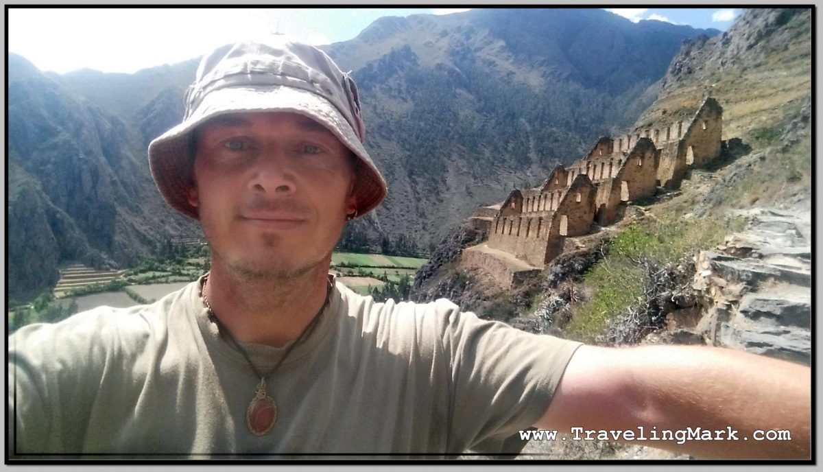
That was certainly the case with me, but whereas I already stood in line and shelled out 152 Soles for the entry ticket, once I had it, I hit the road to get up there. And let me tell you, ascending that hill is no walk in the park.

Photo: Metal Bridges Over the Vilcanota River After Which the Trail Up Hill to Machu Picchu Starts

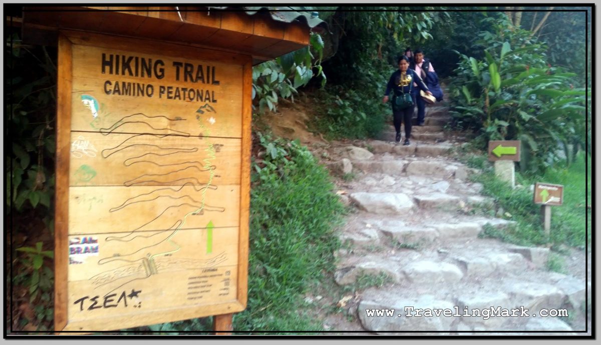
It involved about 15 minutes of backtracking through Aguas Calientes back toward Hidroelectrica, until one reaches the metal bridgeS over the Vilcanota River shortly after which a sign will direct you off the windy road used by the buses and onto the trail for hikers with an apparent wish to spit out their lungs on the super steep hill.

Photo: Beginning of Hiking Trail Up to Machu Picchu Is Marked with This Sign

Let me say that again – that hike is steep. The stone steps laid on the slope to make the hike possible will force you to raise your feet up high to make each step, and it will squeeze every bit of energy out of your thigh muscles so you better have some if you decide to undertake the hike instead of taking the bus. Your heart will be pounding along the way too, as from the moment you take the first step up, all the way to the last, you will be going through some serious cardio exercise with high demand for oxygen.

And as you go up, you realize that once you go down, the strain will be moved from your heart onto your knees. Because the hill is really steep, there is a significant height difference between individual steps so going down will force you to land really hard on your feet, putting high strain on your knees right from the start. And that will last all the way down. I think in my personal case, the way down wore me out more, because my knees really took the beating there. My thighs were trembling by the time I got up, but the muscle exhaustion wore out after a while. The wear to my knees however accompanied me for months after descending Machu Picchu.

Photo: Plaques Paying Homage to Hiram Bingham - Discoverer of Machu Picchu Can Be Encountered at the Top of the Hill
Photo: Plaques Paying Homage to Hiram Bingham – Discoverer of Machu Picchu Can Be Encountered at the Top of the Hill

Also, you better wear a pair of quality hiking boots with strong soles, because going down those steep stone steps will put their durability to the test. And without strong soles on your shoes, it will be the soles of your feet that will take the beating.

As with any challenging hike, make sure you hydrate well before the start and tag along a bottle of extra water to keep yourself hydrated along the way. Some light snack could also be helpful, even though I didn’t bother with one myself.

Whereas the hiking trail follows the right side of the road made for the buses, it intersects with the road on a few occasions, so the option to avoid the steep trail and follow the switchbacks on less steep, but longer road exists. I considered that option a few times, especially while going down because the steep steps were really making it hard on my knees, but whereas it rained on the day of my visit to Machu Picchu, the frequent buses turned the road to muddy hell so continuing along the incomparably cleaner stone trail was much sounder at the time. Moreover, the Peruvian drivers are not particularly known for being respectful of pedestrians so sharing the narrow road with multiple buses squeezing in from both direction could be potentially hazardous to one’s life.

There is one intersection of the hiking trail with the bus road that will force you to walk up the road a bit anyway, and look for the spot where the trail continues. It’s somewhat marked, but not immediately obvious after initially getting on the road.

Along the upper sections of the trail you will encounter a few local women selling refreshments and whereas the majority of the people take the bus up and down the mountain, they are rather aggressive with the few who take the mountain on foot.

Photo: While Most of Trail Up Machu Picchu Mountain Offers No Views, There Are Some Interesting Moments Toward the Top

Overall, if you like to challenge yourself, I’d recommend that you take the hike. Though fact of a matter is that this hike would be done for the challenge, not for the views, as there are hardly any due to the vistas being blocked by trees, but you’ll get the views once you get up to the citadel. If however you’re not somewhat physically fit, or you have sensitive knees, you’re probably better off taking the bus. Although it will likely have been the most expensive bus ride of your life. But then again, everything about Machu Picchu is expensive and it’s purposefully maintained that way.

Hike Up Pinkuylluna Mountain to Ruins of Inca Storehouses in Ollantaytambo

While Ruins of Ollantaytambo are the main archeological attraction in the town of Ollantaytambo, I left them out of my itinerary, as I did many other major archeological sites in and around Cusco, because the entrance fee to those is 140 Soles ($42 US). I simply refuse to support the rip off practices of this magnitude, unless it’s something I could not, for the life of me, afford to miss out on.

Photo: Inside Pinkuylluna Warehouse Ruins

Good thing about Ollantaytambo is that on the opposite side of the town from the main archeological site, is steeply towering Pinkuylluna Mountain, on which there are multiple smaller ruins of Inca storehouses and access to those is entirely free. The only challenge is that one must climb on foot the steel slopes of Pinkuylluna Hill in order to access them. But that’s an adventure in its own right that would be worth while even if there were no ruins on Pinkuylluna. Hell yes I was up for it.

And I wasted no time. As soon as I checked in the Inka Wasi Hostal, I put on Shea Butter which I use as purely natural sun screen, and headed out to hit the slopes.

Face of Viracocha

One quickly observable feature of the Pinkuylluna Mountain is the Profile of the Inca (Perfil del Inca). Said to represent the face of Viracocha – the supreme god of the Incas, the father of all other Inca gods and the creator of the earth.

Photo: Face of the Inca Carved Into Rock Next to Storehouse on Pinkuylluna Mountain

I was told by a local that the face on the side of the mountain is not an orographic whim, but it was sculpted in the rock, and it fulfills an astronomical function related to the seasons – the cultivation cycles – illuminating itself in the solstices in a certain way.

Access to Pinkuylluna Mountain

From Plaza de Armas, enter the old town of Ollantaytambo by way of the street the nearest to the hill (rightmost when facing the old town from Plaza de Armas). Follow the narrow, cobblestone street until you come across a gate on the right hand side.

Photo: Pinkuylluna Hill Entrance Gate

The steep rock steps begin right on the other side of the gate. On the left side of the gate there is a sign informing you that you are at the entrance to the Pinkuylluna Mountain.

Climbing the Pinkuylluna Mountain

The trail up the Pinkuylluna Mountain will get your heart pumping right off the bat. Climbing the hill is basically one major cardio exercise, so by taking the hill on, you’ll get the combination of good heart workout, the best views of the town as well as the main ruins, and the ability to get up close and personal with the storehouse ruins without shelling out a dime.

Photo: Pinkuylluna Mountain Storehouses with Uneven Rock Trail

There were moments during my climb when the gusts of wind were super strong, so not only did I have to hold on to my hat, I had to carefully watch my footing on the narrow rocky trail with deep abyss on its side. If you’re a thrill seeker, you’re gonna love walking the cliff edges of the hill.

Storehouses

The Pinkuylluna storehouses, or mountain granaries, are rectangular structures perched on various parts of the Pinkuylluna Mountain.

Photo: Selfie in Front of Storehouse Ruins on Pinkuylluna Hill

Although the placement of these warehouses on top of the hill may seems strange, the fact that at that height the air is cooler and it moves faster, would help in preserving the food and keeping it ventilated. I also tend to doubt the exhausting hike needed in order to reach the storehouses would attract many would be thieves.

Photo: Main Ollantaytambo Ruins Are Better Visible from Pinkuylluna Mountain

Overall, even though challenging, I found the hike up the Pinkuylluna Mountain, and the exploring the storehouses to be a rewarding experience that was totally worth the effort.

Moreover, with the amazing views of the main Inca fortress, I was happy to be on the hill where there were hardly any other people around, and not within the overcrowded main ruins overrun with thousands of tourists.

Photo: Pinkuylluna Ruins with Town of Ollantaytambo in the Background

If you continue all the way to the top, the ever fainter trail will take you around the hill where you will find a small cave. Few people, including locals, even know about the cave.

Photo: Cave in the Back of Pinkuylluna Mountain

If you’re easily spooked, or suffer from vertigo, a climb up the Pinkuylluna Mountain may be hazardous, but in every other case I would certainly recommend it as an alternative to the overpriced and overcrowded main ruins of Ollantaytambo.

Photo: Bird's Eye View of Ollantaytambo Town with Section of Storehouse Ruins on Pinkuylluna Mountain
Photo: Bird’s Eye View of Ollantaytambo Town with Section of Storehouse Ruins on Pinkuylluna Mountain

Here’s a video of bits and pieces I filmed while hiking the Pinkuylluna Mountain. At times the wind gusts were extremely strong:

Phimeanakas Temple, Angkor Thom

Phimeanakas was the state temple of king Suryavarman I. It was built in late 10th to early 11th centuries which means it was at its location long before the royal city of Angkor Thom was built around it. When king Jayavarman VII had the plan for Angkor Thom laid out, he made Phimeanakas part of his Royal Palace area. Because none of the carvings on Phimeanakas survived, this temple is artistically characterless, however it’s easily scalable and provides interesting views from the top. Perhaps when Baphuon is restored and made accessible by public, the views from up there will be even better, but for now the top of Phimeanakas is the highest you can get at Angkor Thom.

Photo: Phimeanakas Temple Located Within the Royal Palace Area of Angkor Thom

Yes I did climb on top of Phimeanakas and yes it was not particularly easy. The climb itself is not too bad, the western side of the temple (the back of it) has a wooden stairway built alongside the original stone stairway to make for an easier ascend but as is the case of everywhere in Cambodia, it’s not the climb that’ll destroy you, it’s the heat. A few minutes climb up the steep staircase directly exposed to the dilapidating sun will wear you down like a marathon run. The sun will suck out the last drop of energy you had in your body by the time you made it through the initial few steps. Each time you take a breather, it will only get worse. And as if the extreme heat from the sun was not enough, the temple blocks radiate it back at you from below giving you absolutely no way to escape the destructive heat.

Photo: Staircase on the West Side of the Phimeanakas Temple is Steep, but the Easiest to Scale

Reaching the summit doesn’t make it any better. There is nowhere to escape the heat, only the rays of the sun within the blocks of stone where it seems to be hotter than in direct sunshine. The feeling of reaching the top is satisfying even though you will be entirely out of juice. The sanctuary on top is currently empty but was likely used to house a divinity while the temple was in use. According to the Khmer legend, Phimeanakas was crowned with the golden tower within which dwelt a nine-headed naga serpent which transformed into a woman every night. The king was obliged to make love with the serpent every night or else the kingdom would fall into ruin. I guess one of the kings failed in the task as once powerful Angkorian kingdom did eventually fall into ruin.

Photo: View from the Top of the Phimeanakas Temple
Photo: Phimeanakas Central Sanctuary Located on Top of the Temple
Photo: East Face of the Phimeanakas Temple Is in Much Ruin
Photo: Phimeanakas Temple West Stairway is the Best Way on Top