Hidroelectrica to Aguas Calientes – Scenic Walk Along Train Tracks

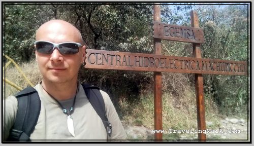
Hidroelectrica, as the last place accessible by a car on the way to Machu Picchu, always has some locals hanging around trying to sell the hoards of tourists passing by stuff. There are also a few restaurants and shops selling fruits and water along the way, but they are all very overpriced. One restaurant I passed also had a sign that they exchanged money, so I asked what kind of rate they offered for US dollars, and the woman told me she’d give me 3 Soles for each Dollar. The official exchange rate at the time was 3.39 Soles for a Dollar, so like everything else, changing money at Hidroelectrica was not worth it.
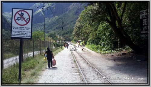
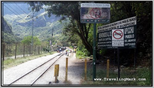
Photo: Beginning of the Foot Trail at Hidroelectrica with Warning that Walking on Train Tracks Is Prohibited

From where you get dropped off, the foot trail follows a train track, but if you follow that one, you will soon hit a dead end. There is a rather inconspicuous turn heading steep up hill to the right after a couple minutes of walking, which looks like it’s a way to one of the restaurants. And it indeed is, but it also gets you to the other train tracks which are higher up. Those are the tracks that go around the hill all the way to Aguas Calientes.
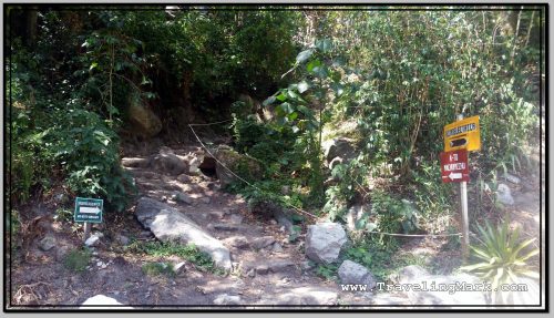
Photo: You Need to Take This Detour from Main Trail at Hidroelectrica in Order to Get on Right Path to Aguas Calientes

So basically, if right at the beginning of your trek from Hidroelectrica to Aguas Calientes you did not get your heart pumping by following a trail heading steeply up the hill to your right, you’re going the wrong way and will have to backtrack because the trail you are on leads nowhere. I did it too.
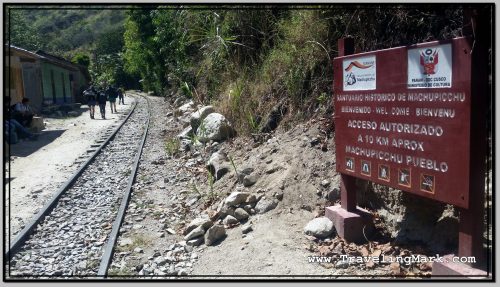
Photo: This Is the Upper Trail That Actually leads to Aguas Calientes

Once on the upper tracks, you’re good to go. Several minutes in and you will pass under a short tunnel, and a few more minutes later, you’ll hit a bridge over the Vilcanota River which has carved the canyon that forms the base for Machu Picchu.
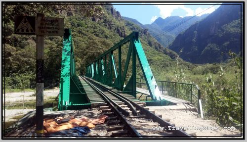
Photo: Railway Bridge Over the Vilcanota River with Footpath on the Right

There are several signs along the tracks informing you that it’s prohibited to cross the tracks, but at a number of locations, the tracks cross over creeks giving the hiker no option but to actually walk on the tracks. Besides, the trail that follows the tracks is at one point on the left, and at the other on the right, so like it or not, you will cross on the tracks several times.
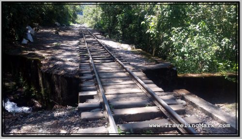
Photo: Hiker to Aguas Calientes Will Have to Walk on Train Tracks Because of Passes Over Creeks Like This One

Even though the trail is at the bottom of the canyon carved by the Vilcanota River and follows the hill housing Machu Picchu, you will not get any reasonable glimpse of the lost citadel from down there. Still, unless it rains on you, the walk is scenic and the nature as well as the surrounding hills spectacular. You may even get passed by one of the trains.

There are a few restaurants along the trail as well, but as with everything in this proximity, they are expensive. One fellow with a stall was selling young coconuts, but wanted way too much for them so I gave it a pass. It would have been nice to recharge with natural electrolytes, but not at 10 Soles a pop.
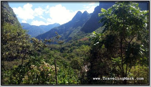
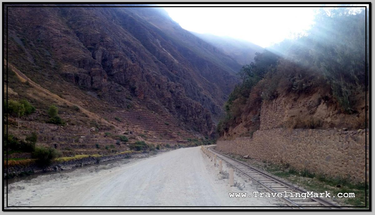
Photo: Hidroelectrica to Aguas Clientes Trail Offers Spectacular Views, But View of Machu Picchu Remains Hidden

If you’re a fast walker and keep your foot steady on the rocky trail, you should get to Aguas Calientes in about an hour and a half from Hidroelectrica. Except for the short uphill steep hike at the beginning, the trail is flat, so it’s not that brutal on your cardio. It’s just a bit hard on the feet, because it’s rocky, so make sure you have good hiking boots on.
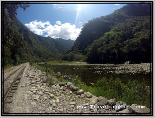
Photo: Except in Beginning, the Trail to Aguas Calientes is on Flat Surface and Tracks the Vilcanota River

But then, once you get to Aguas Caliente, unless you’re cool staying in one of the priciest hotels at the beginning of the town, your trip will finish you off with forcing you to hike steep streets of the town to get to the more economical hostels. There is a tone of them in Aguas Calientes, as the town is as touristy as it gets. But if you’ve made it there, you’ve made it to the foot of Machu Picchu.
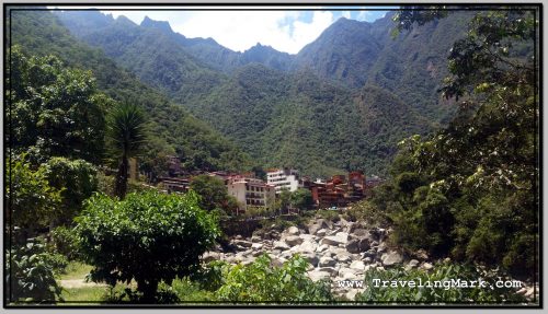
Photo: First Glimpse of Aguas Calientes from Trail After 10 Kilometers of Walking from Hidroelectrica

Other than in Aguas Calientes, the only way to stay any closer to Machu Picchu would be to book a room at Belmond Sanctuary Lodge, where a night costs $1,000+. If you’re one of the poeple who can afford to shell out this much for a night in a hotel, then you will sleep outside the entrance to the Inca Citadel. For the rest of us, there is Aguas Calientes, or Mchu Picchu Pueblo, as the Peruvian government is trying to rebrand the town.
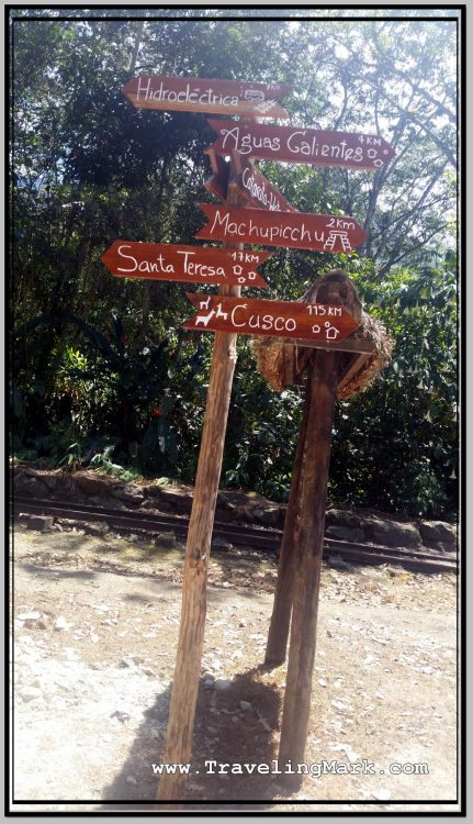
Photo: Tourist Signage on Trail Between Hidroelectrica and Aguas Calientes

Here’s also a short video of a PeruRail train that passed me by about three quarters of the hike to Aguas Calientes. This seems to have been just a locomotive that didn’t have any couches transporting people hooked on:
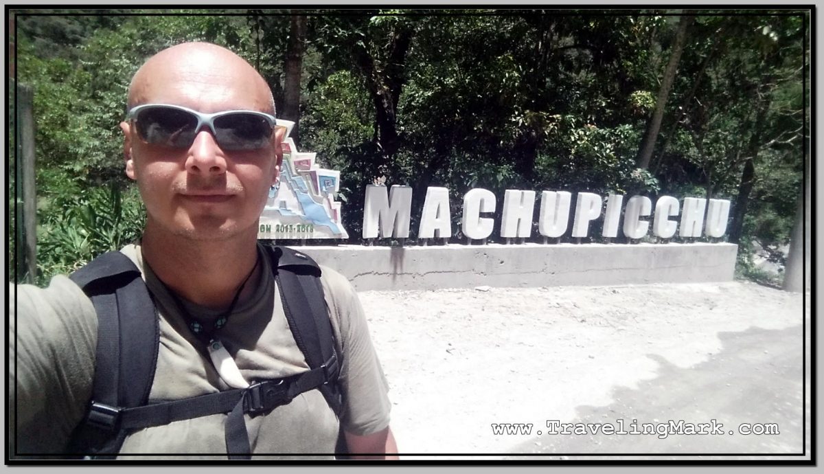
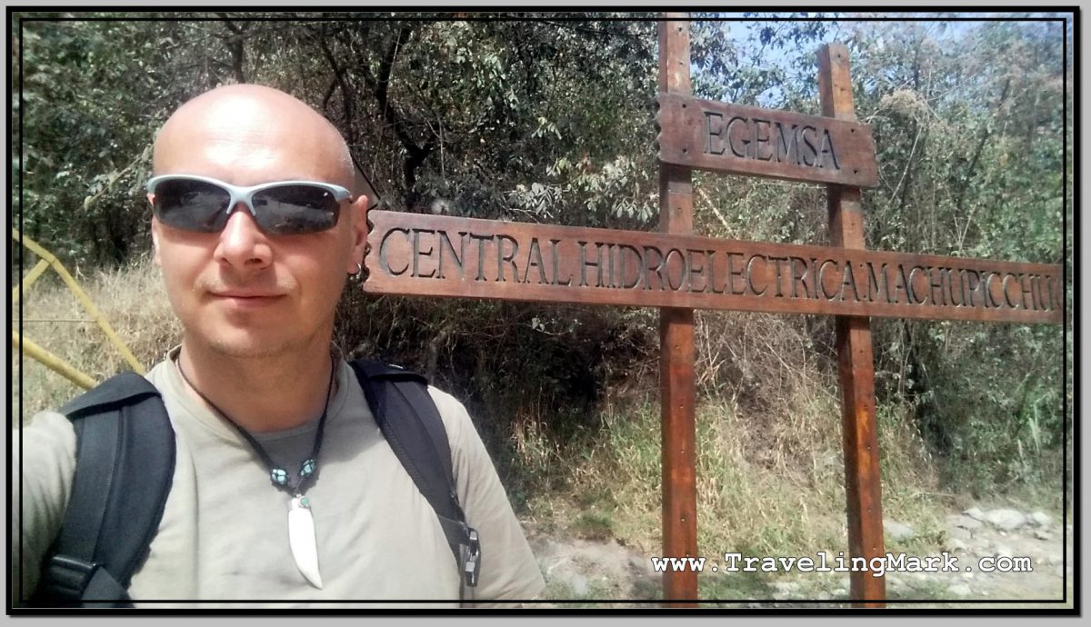
Trip from Santa Teresa to Hidroelectrica – As Close As Car Can Get to Machu Picchu

There were no roadblocks between Santa Teresa and Hidroelectrica, which in my mind earned Santa Teresa my support in form of paying for the hotel and the supper, and buying the water and the fruits – something I refused to do in Santa Maria, where the services were also available, but the town resorted to road blockages to make the lives of tourists more difficult, and with it, the trip to Machu Picchu one of the worst experiences I’ve had.

Photo: Hidroelectrica Is As Close to Machu Picchu As One Can Get by Car

I didn’t however intend on staying in Santa Teresa more than one night, so as soon as I got up in the morning, I checked out of the hostel and headed for the Mercado de Santa Teresa from where depart shared cabs for Hidroelectrica – the nearest spot to Machu Picchu where it’s possible get with a car.

The local transport cabs, called “colectivos“, leave when full. When I arrived, there was only one more person waiting to go to Hidroelectrica so I had to wait until two more showed up for the driver to depart. It took an hour before the car was full, but eventually we departed.

Photo: Piles of Bagged Plastic Bottles Encountered at Hidroelectrica Station Before Machu Picchu

The way to Hidroelectrica, much as the path to Santa Teresa from Santa Maria, is along a scenic canyon carved by the Vilcanota River and it’s not paved. The dusty roads are narrow and the drivers don’t appear to mind the hundreds meters long drops when two vehicles going the opposite way meet on it. With mere inches separating the beat up cars from deadly plummets, the experience of taking a colectivo to Hidroelectrica is an adrenaline filled, hair raising, and butt cheeks squeezing one. Good luck if you suffer from vertigo…

Even though the majority of tourists I encountered on the way between Santa Teresa and Hidroelectrica walked the trail on the steep canyon walls on foot, after a long walk the day earlier, I chose to pay for the cab to take me to Hidroelectrica the easy way – except for about a half a dozen of heart attack inducing passes that the driver took.

Photo: At Hidroelectrica the Drivable Road Ends and Tourists Have to Continue on Foot Along the Railway Tracks

At Hidroelectrica, the drivable road ends and what continues on is a narrow rocky footpath alongside the railway tracks. The Peruvian government could easily pave a road all the way to Machu Picchu, and could have easily done that a long time ago, but by doing that they would permit the tourists to arrive at Machu Picchu without getting ripped off on the unbelievably overpriced trains, which are promoted as the sole means of access to Machu Picchu that doesn’t require strenuous walking.

The train ride, which costs the locals 10 Soles (less than $3 US), would cost a foreigner up ro $485 one way. That’s why the Peruvian government laid down the railway tracks, but refuses to lay down a road. Without road access, a tourist has but two options – shell out the insane cost for the train, or face a gruelling and complicated road with the mandatory hour and a half long hike on foot on a rocky trail.

Somehow, even though there are many much cooler and worthwhile places all over the world, the Peruvian government succeeded in pimping Machu Picchu as that super iconic place, and tricked the whole world into falling for it, thus generating massive profits for itself while ripping tourists off by refusing to create a road access to the place.

Ollantaytambo Off the Beaten Path – Inca Bridge and the Pyramid

Having arrived from Cusco, gotten a room, explored the ruins on the Pinkuylluna Mountain, and filled my belly with fried trout, I felt like I’ve seized the day pretty well, but whereas I still had an hour until the sunset, I decide to get off the beaten path in Ollantaytambo and explored its least visited areas.

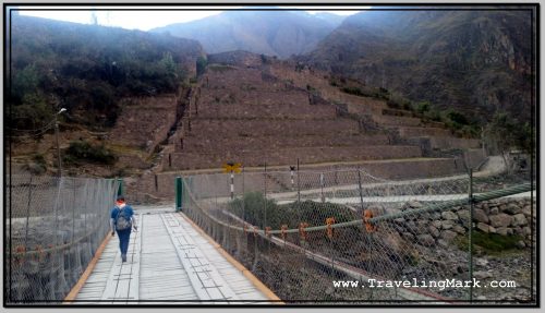
Photo: Pedestrian Uses Suspension Bridge to Walk Toward the Pyramid

I found out while messing around the town’s main square of Plaza de Armas that just outside of the town boundaries on Ollantaytambo’s south-east side, can be encountered the ruins of an ancient Inca bridge, and that near said bridge lay also the ruins of an Inca pyramid. I hit it off to check those out.

Getting to the Inca Bridge

I started the walk from the south-eastern corner of Plaza de Armas and followed the road due east, passing the small market with incredibly overpriced fruits (Peru is expensive to begin with, but it’s even worse as you get closer to Machu Picchu – Ollantaytambo was second only to Aguas Calientes, which is at the foot of Machu Picchu), and onward down the road, until I reached a T intersection. There I turned left and after a few meters immediately right to carry on due east.

On that road I passed Inka Paradise hotel and some kind of a school, after which there was a narrow pedestrian dirt road through a field. That road leads to the bridge. Except at the end of it, there’s a cliff that needs to be descended so if you didn’t take the stroll in your hiking boots, you will only get to enjoy the bird’s eye view of the bridge, and no pyramid.

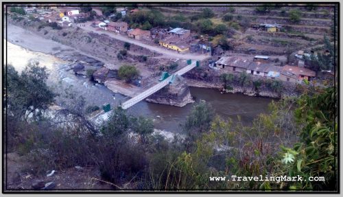
Photo: Bird's Eye View of Suspension Bridge Built Over Old Inca Bridge
Photo: Bird’s Eye View of Suspension Bridge Built Over Old Inca Bridge

An alternative is to go around town by following the road back to Cusco, but that road is narrow with no sidewalks to safely walk on and the drivers don’t pay much respect to pedestrians.

Inca Bridge

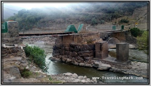
There isn’t a whole lot left of the ancient Inca Bridge. Just the support column erected in the middle of the Vilcanota river still holds the original stones used for its constructions. Nowadays, a newly built suspension bridge connects that banks of the river, still utilizing the remnants of the old Inca structure.

Photo: Rocks in the Middle of the River Are Remains of the Old Inca Bridge

Along the Ollantaytambo side of the river there are railway tracks leading to Aguas Calientes, but no road so tourists don’t have the means to get themselves near Machu Picchu, and are stuck having to use the train for which they are charged more than 100 times the cost of the locals. It is a major and blatantly deliberate rip off which I refused to support.

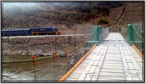
Photo: PeruRail Train Passed By While I Was on the Inca Bridge in Ollantaytambo

While I was at the bridge, a train with ripped off tourists returning from Machu Picchu back into Cusco passed bay.

Ollantaytambo Inca Pyramid

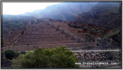
On the other side of the tracks from the bridge is the pyramid. It is a cascading stone structure build into the slope. I didn’t come across any reasonable kind of backinfo about the pyramid, except that it’s there, near the bridge next to the tracks.

Photo: Ollantaytambo Inca Pyramid Seen from the Opposite Side of the River

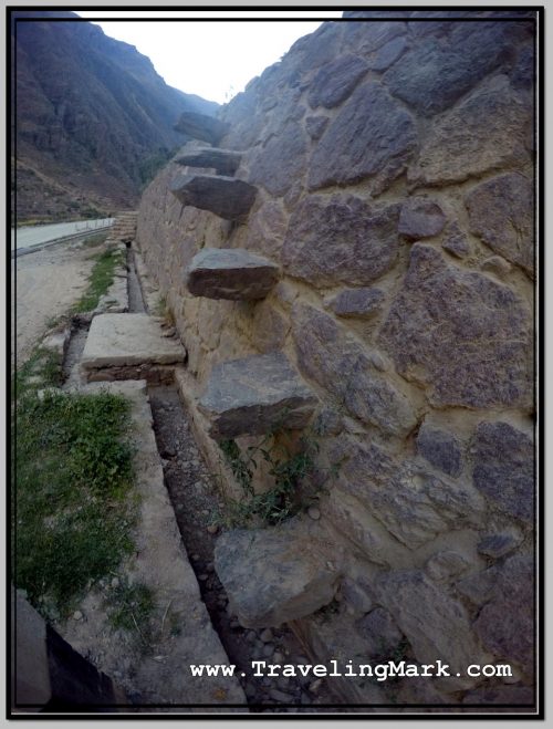
Te pyramid had a set of protruding stones built into the outer wall, to serve as steps for ascend. Despite dodgy looking purpose, those steps are solid and absolutely safe to walk on, having withstood the test of time – centuries after being built, they are still there in their original form after affording countless people the way up on the pyramid.

Photo: Rock Steps Built Into the Outer Wall of Ollantaytambo Pyramid

Because the way I came to the area involved a descend down a very steep cliff including a near 2 meter jump, going the same way back was not an option, so I walked around town down the paved road from Cusco.

The vast majority of people who come to Ollantaytambo will only visit the fortress – having shelled out some $43 for the entrance to the archeological sites within the Sacred Valley of the Incas. They come on buses as part of organized tours which only take them to the fortress and nowhere else. So whereas the fortress is overrun with hundreds of tourists every single day, the nearby Pinkuylluna Mountain, which is free to visit receives very few visitors, but when it comes to the Inca Bridge and the Pyramid on the opposite side of the river, your chances of spotting another tourist around them are next to none.