Baphuon Temple of Angkor Thom

Baphuon temple is located to the north-west of Bayon. It was built in 1060 which means it stood at its location long before the royal city of Angkor Thom was built around it. Erected during the reign of king Udayadityavarman II (ruled from 1050 to 1066), Baphuon was the state temple of Yasodharapura. Being a very old structure, Baphuon is in a great state of ruin and in desperate need of repair. Unfortunately for me, restoration works were well underway during my visit with main area of the temple mountain being off limit to tourists. Several high cranes were spoiling the view so pictures look rather crappy. It has been known for centuries that Cambodians are the laziest people in the world, but luckily the Baphuon restoration project is financed by the government of France with foreign workers involved so hopefully the temple will open for public soon.
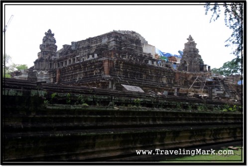
Photo: Baphuon Temple of Angkor Thom

The entrance gopura is in line with the Terrace of the Elephants which serves as an entry point to the royal palace area. Few steps got me on a narrow, 172 meters long causeway leading to the temple. The causeway must have been added later as it’s no where near as collapsed as the temple itself. There were two basins on each side of the causeway and one rectangular shaped basin to the south of the cross shaped pavilion in the middle of it.
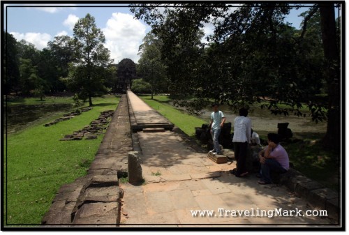
Photo: 172m Long Causeway Leading to the Baphuon Temple with Lazy Locals Killing Time

Even though I couldn’t access the temple itself, I stood in awe over its size. It appears to be taller than nearby Bayon and consist of four or five floors (unlike Bayon which only has three). I walked around Baphuon noticing countless stone blocks randomly scattered along the fields surrounding the temple. Construction noise was coming from within giving an impression that works are being done to make the temple accessible to public one day. Wooden stairs are being built for easier access to upper levels of the temple but how long it’ll take to make it safe for visiting is anyone’s guess.
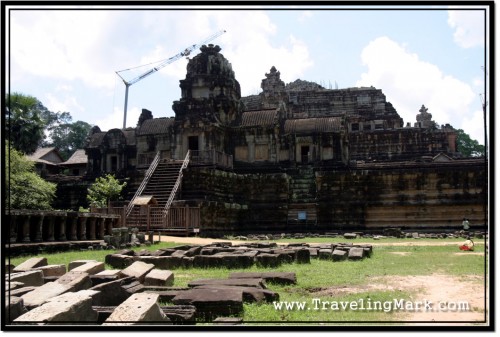
Photo: Cranes Towering Over Baphuon Temple in Angkor Thom

I understand there is an impressive statue of a reclining Buddha in western gallery of the second tier, but for obvious reasons I never got to see it. I can also imagine the view of Angkor Thom from the summit much be impressive. Perhaps one day when restoration of Baphuon is finished and temple made available for visit, I will make it back to Cambodia and get to see what I couldn’t during my first visit.
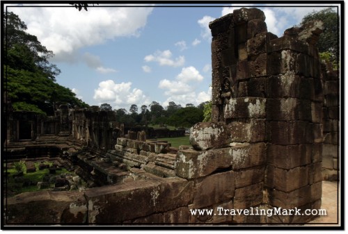
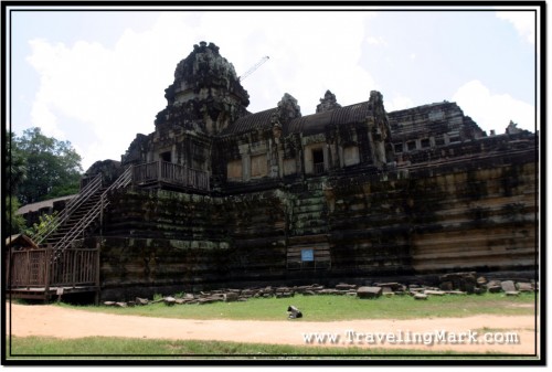
Photo: Much of Baphuon Temple is in Ruin
Photo: Restoration Works on Baphuon Temple Include Installation of Wooden Stairs

Angkor Thom

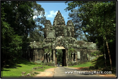
Angkor Thom means “Great City” in Khmer language. Covering the area of 9 kilometres squared, the royal city of Angkor Thom was the last capital of the Angkorian Empire. Completely surrounded by wall and moat that’s almost 3 kilometres long on each side, there are five entrance gates to the royal city – one at each cardinal point and the Victory Gate which connected the east side with the Royal Palace. Each of the Angkor Thom gates is crowned with four giant faces, similar to those found on Bayon temple.

Photo: Victory Gate of Angkor Thom, View from the West

Angkor Thom as we know today was constructed over the site of earlier temples and was occupied by city people for five centuries. It was brought to its final glory by King Jayavarman VII though construction of Angkor Thom continued to certain degree after his death.

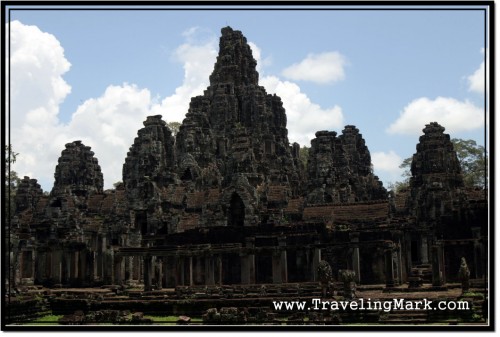
The remodelling to Angkor Thom to its current state started after King Jayavarman VII drove away Chams who sacked the city. The King remodelled what was left of Angkor Thom into an ensemble that represents the Mount Meru with Bayon in its centre and the moat around it representing the sea of milk that encircles the sacred mountain range. It’s a microcosm of the universe.

Archaeologists speculate that during its boom, Angkor Thom had a water system running through the city. River O Khlot may have been branched and have some of its flow diverted to supply the royal city with life supporting water.

King Jayavarman VII also built temples at each corner of Angkor Thom. These temples, known as Prasat Chrung (Shrine of the Angle) contain an architectural element called “stele” which is an upright slab with inscriptions. The south-eastern Prasat Chrung is the only one with a stele containing complete inscription in Sanskrit on all four sides of the slab. Prasat Chrung temples were dedicated to the Bodhisattva Lokesvara, same as Bayon which served as city’s state temple.

Photo: Bayon, State Temple of Angkor Thom

Parts of today’s Angkor Thom, the last capital of Angkorian Empire overlap the area of what used to be Yasodharapura – the first capital of Angkorian Empire (9th century). Temples of Baphuon and Phimeanakas which still exist within today’s Angkor Thom were built in previous centuries and were incorporated into the new layout of Angkor Thom by Jayavarman VII.

Following the tradition, the royal palace was built north of the state temple (in this case it was Bayon). There is nothing left of the royal palace but the courtyard and terraces, as dwellings of people, including royalty were built of wood. Stone dwellings were reserved exclusively for the gods.